

Asia Pacific Travel Team
Indian Tourism
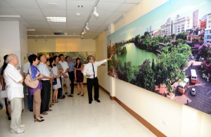
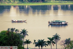
Indian Tourism: Hanoi / Ho Chi Minh City - Lolkata - Bodhgaya - Rajgir
America Tralvel
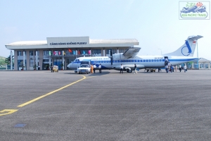
America Tralvel: Maritime Exhibition specialized in SEATTLE 2012
Taiwan Travel
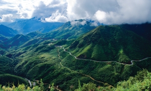
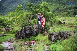
Taiwan Travel: TP.City - Kaohsiung - Taichung - Taipei - Lotus Park Son (January 2/2013)
Korea travel
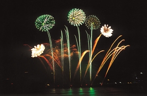
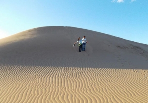
Korea travel: HCMC - Seoul - Nami Island (11,12/2012)
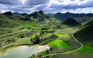
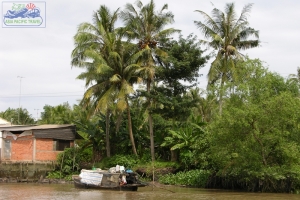
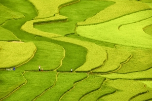
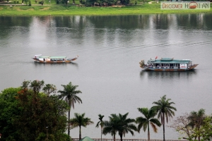
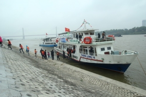
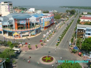
VINH LONG PROVINCE
Square: 1479,1 km2
Population: 1026,5 thousands people (2010)
City: Vinh Long City
Districts: Long Ho, Mang Thit, Binh Minh, Tam Binh, Tra On, Vung Liem, Binh Tan.
OVERVIEW
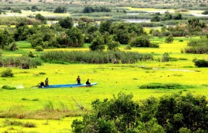
Coming to there, visitors have chance to walk among the trees, relax in hammocks, try all kinds of delicious tropical fruits in the gardens of An Binh and Binh Hoa Phuoc islands. Several popular places are Mr. Sau Giao's Flower Garden, Mr. Muoi Day's Stilt-House, and Mr. Hai Hoang's Old House. Vinh Long has many pagodas, communal houses such as Van Thanh Temple, Long Thanh Communal House, Tinh Xa Ngoc Vien, Phuoc Hau, Tien Chau, Saghamangala pagodas...
GEOGRAPHY
Situated between the Tien and the Hau rivers, Vinh Long Province is bounded by Tien Giang Province on the north, Dong Thap Province on the north-west, Tra Vinh Province on the south-east, Hau Giang and Soc Trang provinces on the south, and Can Tho City on the south-west.
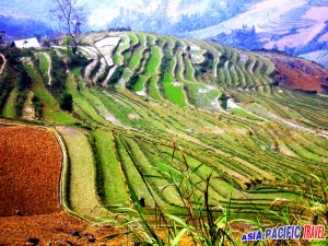
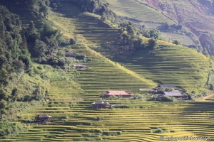
The terrain is quite flat. The complex network of rivers and canals make convenient transportation. The soil is rich in alluvium, favorable for rice and various fruit cultivation.
CLIMATE
The dry season lasts from December to April, the rainy season last from May to November. The annual average temperature is 27ºC. Average rainfall is from 1,300mm to 1,500mm.
TOURISM
Silt from Tien and Hau rivers has raised the level of the field. The majority of inhabitants live on farming, fruit planting and cattle rising.
Coming to there, visitors have chance to walk among the trees, relax in hammocks, try all kinds of delicious tropical fruits in the gardens of An Binh and Binh Hoa Phuoc islands. Several popular places are Mr. Sau Giao's Flower Garden, Mr. Muoi Day's Stilt-House, and Mr. Hai Hoang's Old House.
Vinh Long has many pagodas, communal houses such as Van Thanh Temple, Long Thanh Communal House, Tinh Xa Ngoc Vien, Phuoc Hau, Tien Chau, Saghamangala pagodas...
TRANSPORT
Vinh Long is 70km from Mytho, 34km from Can Tho and 136km from Ho Chi Minh City. The inter-province bus station is 5km from the centre of Vinh Long. There are buses between Vinh Long and Ho Chi Minh City, Can Tho, Mytho, Long Xuyen, Sa Dec, Rach Gia, and other Mekong Delta destinations. National Highway No.1A and No.53 also runs through the province.
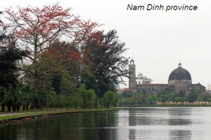
NAM DINH PROVINCE
Square: 1,650.8 km2.
Population: 1,830,000 people (2010)
City: Nam Dinh City.
Districts: Vu Ban, My Loc, Y Yen, Nam Truc, Truc Ninh, Xuan Truong, Giao Thuy, Nghia Hung, Hai Hau.
OVERVIEW
Nam Dinh, lying in the southern Hong River delta, is bordered by Ha Nam to the North, the Gulf of Tonkin in the South-East, by Thai Binh to the East and Ninh Binh on the West. With 72 kilometres of coast line and 4 large rivers; the Red, Dao, Day and Ninh Co, water plays a large part in the life of Nam Dinh. As a coastal province the mountains and hills are low in stature.
GEOGRAPHY
Situated on Red River Delta, Nam Dinh is contiguous to Ha Nam, Thai Binh provinces on the north, Ninh Binh Province on the west and the East Sea on the east with 72km seaside. Nam Dinh is not only a granary of midland in the North but also a center of textile industry in Vietnam.
TOURISM
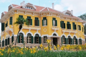
Nam Dinh is proud of Tran Royal Remains on Tuc Mac Village, the native land of the Tran Kings and national hero Tran Hung Dao, comprising Thien Truong and Co Trach temples and Pho Minh Pagoda and Tower. The province is also famous for Phu Day Remains on Vu Ban District. These remains including Phu Tien Huong (the Tien Huong Temple), the Van Cat Temple and the tomb of Goddess Lieu Hanh have high value of architecture.

Pho Minh Tower - Nam Dinh Province
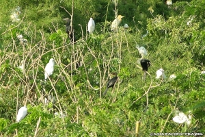
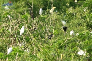
Coming to Xuan Thuy National Park, tourists enjoy observing many of special birds, 9 types of which are listed in the world's Red Book. From November to April, it is a gathering place for tens of thousands of birds migrating from the North. Beside that, tourists are interested in admiring varieties of orchids, camellias and roses in Vi Khe Ornamental Plant Village, swimming in Thinh Long Beach.
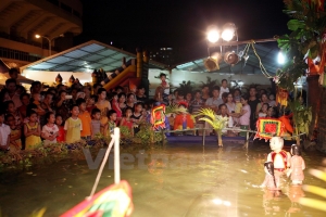
Every year, Nam Dinh held special traditional events like Vieng Fair, Phu Day, Co Le, Dai Bi, Keo Hanh Thien, Vong Cung pagodas, Tran Temple festivals. Cheo, van, xam songs, puppet showing and boat racing are preserved here.
TRANSPORT
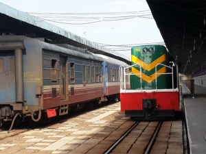
Nam Dinh is 90km from Hanoi. Reunification Express Train from Hanoi to Ho Chi Minh City stops in Nam Dinh. National Highway No.21 links National Highway No.1A to center of Nam Dinh. National Highway No.10 from Ninh Binh Town to Thai Binh, Hai Phong, Quang Ninh provinces via Nam Dinh.
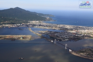
NGHE AN PROVINCE

Square: 16,498.5 km2.
Population: 2,917,400 people (2010)
City: Vinh City
Districts: Dien Chau, Quynh Luu, Yen Thanh, Do Luong, Nghi Loc, Hung Nguyen, Nam Dan, Thanh Chuong, Tan Ky, Anh Son, Con Cuong, Nghia Dan, Quy Hop, Quy Chau, Que Phong, Tuong Duong, Ky Son.
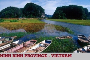
NINH BINH PROVINCE
Square: 1,392.4 km2.
Population: 900,600 (2010)
City: Ninh Binh City
Districts: Nho Quan, Gia Vien, Hoa Lu, Yen Mo, Yen Khanh, Kim Son.
OVERVIEW
Situated on the Red River Delta, Ninh Binh separates the North and the Central Vietnam by Tam Diep Mountain Range. It is surrounded by Hoa Binh, Ha Nam provinces on the north, Nam Dinh Province on the east and Thanh Hoa on the west and the south.
GEOGRAPHY
Situated on the Red River Delta, Ninh Binh separates the North and the Central Vietnam by Tam Diep Mountain Range. It is surrounded by Hoa Binh, Ha Nam provinces on the north, Nam Dinh Province on the east and Thanh Hoa on the west and the south.
CLIMATE
Ninh Binh's topography is divided clearly into 3 parts: the mountainous area in the west and northwest; the delta and coastal area in the east and south. Ninh Binh has Day, Van Sang rivers, and Non Nuoc, Canh Dieu mountains. Annual average temperature is 23.4ºC.
TOURISM
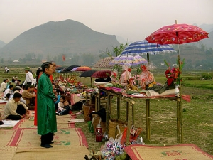
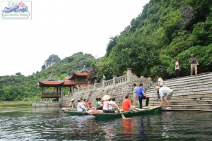
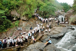
In Ninh Binh, Hoa Lu Ancient Capital (in Truong Yen Commune, Hoa Lu District now) was chosen as the first capital of Vietnam feudal centralism regime and the Dai Co Viet's political, economic and cultural centre with the name of Kings Dinh Tien Hoang, Le Dai Hanh and Ly Thai To in 10th century. In 1010, King Ly Thai To moved the capital from Hoa Lu to Thang Long (Hanoi now), opening a new era for Vietnamese people.

Hoa Lu Ancient Capital - Ninh Binh Province
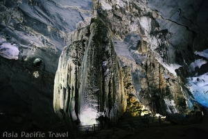
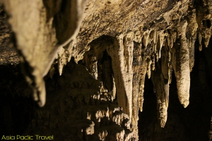
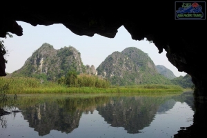
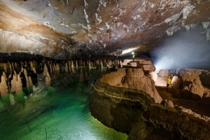
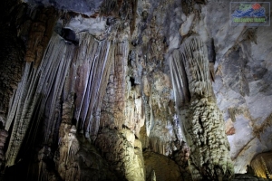
Ninh Binh owns beautiful Tam Coc, Bich Dong, Dich Long, Hoa Son, Tien caves, Van Trinh Grotto and other special landscapes following:
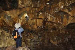
Cuc Phuong National Park is home of varies of strange flora and fauna. Especially it is enjoyable to touch the thousand-year-old cho xanh (parashrea stellata) and sau (Dracontomelum Duperranum or Dancorra Edulis) trees, 50-70m high. The park is also suitable to watch birds, butterflies and orchid flowers.
Phat Diem Cathedral is a solemn and interesting architectural complex, reflecting the skilful and excellent stone carving art of the Vietnamese workers.
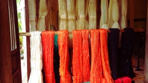
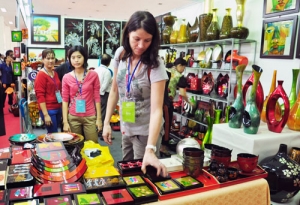
Ninh Binh's people have created such famous and traditional products as Kim Son's fine arts, Hoa Lu's high-class embroidery, hanger products and rocky sculpture products for export, Gia Vien's rattan and bamboo knitting products, etc.
TRANSPORT
Located 90km far from Hanoi, Ninh Binh has convenient waterway and road networks of transportation. The Reunification Express Train from Hanoi to Ho Chi Minh City stops at Ninh Binh Town. National Highway No.10 connects to Nam Dinh, Thanh Hoa provinces and National Highway No.12B links to Hoa Binh Province.
NINH THUAN PROVINCE
Square: 3,363.1 km2.
Population: 570,100 people (2010)
City: Phan Rang - Thap Cham City
Districts: Ninh Hai, Ninh Phuoc, Ninh Son, Bac Ai, Thuan Bac.
OVERVIEW
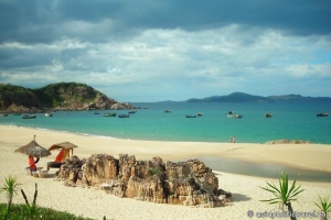
Ninh Thuan province is lying in the middle of Central Viet Nam, has a small plain created by the Dinh River originating from Lam Vien Plateau. The province is famous for white-sand beaches, vast gardens of table grapes, onions and hot peppers. The province is also inhabited by a great number of the Cham ethnic minority people.
HISTORY
The Cham principality of Panduranga had its center in Ninh Thuan Province, but also included much of what is now Binh Thuan Province. Panduranga became the political centre of Champa after the fall of Vijaya in 1471. It remained independent until 1832, when emperor Minh Mang annexed it.
Ninh Thuan was merged into Binh Thuan Province in 1976, together with Binh Tuy Province. Ninh Thuan became a separate province again in 1991.
GEOGRAPHY
Located in South-Central Coast, Ninh Thuan shares border with Khanh Hoa Province on the north, Lam Dong Province on the west, Binh Thuan Province on the south and East Sea on the east.
The terrain is a mixture of mountain, plain and seaside. Main rivers name Sat, Cai, Ong, Gia, Can, La, Quao. Mountains surround three faces of Ninh Thuan including Tha Nhonh, Chuan, Suong Mu, and Hon Dien mountains. Long seaside makes Da Vach, Thi, Ca Na capes and sea ports.
CLIMATE
The climate is a combination of the tropical monsoon and dry and windy weather. It is hot, dry, windy all of year. There is two seasons: the rain season lasts from May to November, the dry season lasts from December to April. Annual average temperature is 27ºC.
TOURISM
Ninh Thuan belongs to tourism triangles: Da Lat - Nha Trang - Phan Rang. Coming to there, tourists are able to relax in Ca Na Tourist Site, swim in Ninh Chu Beach, Vinh Hy Bay, climb to Da Trang Mountain, and observe natural animals in Phan Rang Reservation, or visit Pi Nang Tac Stone Trap.
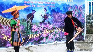
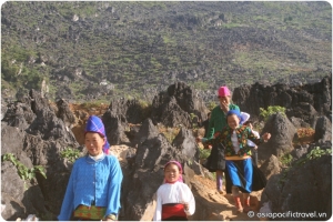
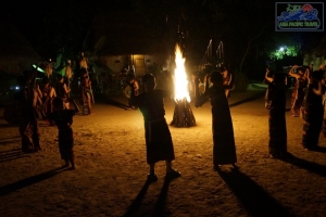
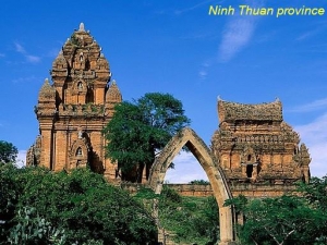
Being home of Cham minority group, Ninh Thuan has characters culture of Cham ethnic, which stamp in local custom, Cham dance, sculpture, pottery, and brocade and agriculture of Cham towers. Famous towers name Po Klong Garai and Porome.
Nowadays, Cham people still preserve matriarchy, a valuable inheritance of Vietnam, and special festivals such as Kate, Cha Bun ceremonies, Royal Idiladha and Ra Glai Tribe festivals and other ceremonies like dig a ditch, dam up, new rice.
TRANSPORT
Phan Rang - Thap Cham City is 105km from Nha Trang, 110km from Da Lat, 350km from Ho Chi Minh City and 1.382km from Hanoi. Phan Rang Town is on North - South Express Train, National Highway No.1A and National Highway No.27.
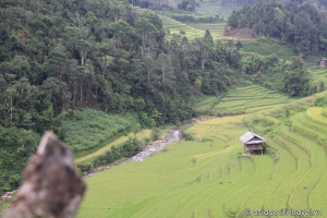
PHU THO PROVINCE

Square: 3,528.4 km2.
Population: 1322,100 people (2009)
City: Viet Tri City.
Districts: Ha Hoa, Thanh Ba, Doan Hung, Lam Thao, Thanh Son, Yen Lap, Tam Nong, Thanh Thuy, Phu Ninh, Cam Khe, Tan Son.
OVERVIEW
Phú Thọ Province is a province in northeastern Vietnam. The province's name derives from and its capital is Viet Tri City, which is 80 kilometres (50 mi) away from Hanoi and50 kilometres (31 mi) from the Noi Bai International Airport.The province covers an area of 3528.1 square kilometres and as of 2008 it had a population of 1,364,700 people.
HISTORY
The history of the area is traced to Den Hung (Hung Temple), located on the Nghia Linh Mountain, which is taken as evidence of the historicity of the province and the 18 Hung Kings who are credited with building the nation of Van Lang. Hence, the province is considered the first state of Vietnam, with Phong Chau as its capital. This historical lineage has made this province the ancestral land of Vietnam. There are many festivals in the province linked to this history.
In December 1999, Nguyen Thi Thuy, the leader of an unregistered Protestant house church in the province, was sentenced to one year in prison for "interfering with an officer doing his duty", which caused some religious controversy in the province.
GEOGRAPHY
Located in the Plains and Midland in the North of Vietnam, Phu Tho shares border with Tuyen Quang, Yen Bai provinces on the north, Vinh Phuc, Ha Tay provinces on the east, Son La Province on the west and Hoa Binh Province on the south.
The terrain is mainly made up by hills. There are also three big rivers namely Red, Da and Lo rivers running through Phu Tho.
CLIMATE
Phu Tho has a monsoon tropical climate with a cold winter and hot summer, annual average temperature of 23ºC, annual average rainfall of 1600-1800mm and annual average humidity of 85-87%.
TOURISM
Phu Tho is consider as ancestral land of Vietnam. Den Hung (Hung Temple) Remains is tied to the legend about 18 Kings Hung who built Van Lang State, the first one of Vietnam, with Phong Chau as the capital.
Phu Tho has bright culture. Archaeological sites like Son Vi, Dong Dau, Lang Ca and many pagodas, temples, tombs around Nghia Linh Mountain prove that Phong Chau used to be cultural center of ancient Vietnamese.
Xuan Son National Park and Ao Chau Pond are famous beauty spots of Phu Tho. Every year, Xuan Son attracts many tourists to come for recreation and discovery diversified flora and fauna. Heading for Ao Chau, tourists can enjoy the fresh air and taste local specialties like fruits, carps, turtles, crabs, snails and so on.

Hung Temple Festival - Phu Tho Province
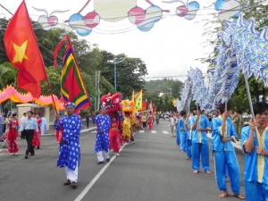
Phu Tho is home of many festivals including Bach Hac, Chu Hoa, and most honorable one is Den Hung Festival. This festival is on 10th day of the 3rd lunar month annually corresponding to the anniversary of the Kings Hung. Now, it becomes a great ceremonial festival of the Vietnamese nation.
Beside of these, the people here preserve some traditional songs: xec bua, vi, dum, xoan, gheo songs.
TRANSPORT
Viet Tri City is 80km from Hanoi. It is on National Highway No.2 linking Hanoi with Ha Giang Province and China Border. The train from Hanoi to Lao Cai stops at Viet Tri