

Asia Pacific Travel Team
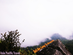
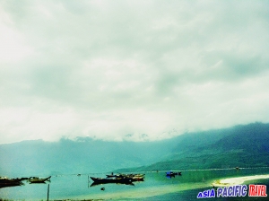
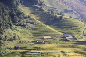
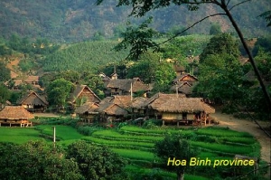
HOA BINH PROVINCE
Square: 4,684.2 km2
Population: 793,5 thousands people (2010)
City: Hoa Binh City
Districts: Da Bac, Mai Chau, Ky Son, Cao Phong, Luong Son, Kim Boi, Tan Lac, Lac Son, Lac Thuy, Yen Thuy.
OVERVIEW
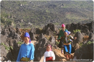
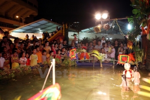
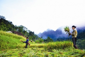
Hoa Binh province is known to be an origin of “Hoa Binh culture” - the cradle of Vietnamese ancient culture. Besides, tourist and humanity resources are diversified, plentiful and attractive with 184 historic sites, cultural sites and natural landscapes together with unparalleled cultures of ethnic groups like Muong, Thai, Mong, Tay and Dao expressed in building architectures, beliefs, customs and traditional festivals.

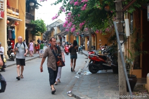
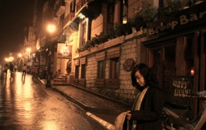
Hoa Binh Province - Vietnam tourism
HISTORY
Hoa Binh province was created on June 22, 1886 following the decree of Tonkin with the name Mường Province, splitting Muong majority areas from Hung Hoa province, Son Tay province, Hanoi and Ninh Binh province. Its name derives from the Sino-Vietnamese 和平, meaning "peace."
The province was administered from Chợ Bờ (in Đà Bắc) hence it was also known as Chợ Bờ Province, until it November of the same year, it was relocated to Phương Lâm district (today in Bất Bạt district, Ha Tay province). In April 1888 it was renamed to "Phuong Lam province", by the French colonial authorities.
On March 18, 1891 the Governor-General of French Indochina decreed that the name of the province would change to Hòa Bình Province with six districts: Luong Son, Ky Son, Lac Son, Lac Thuy, Mai Chau and Da Bac.
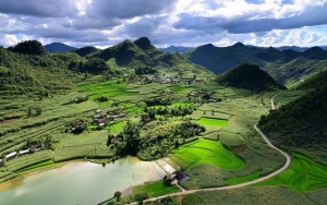
GEOGRAPHY
Hoa Binh is a mountainous province in the North. It is bordered by Phu Tho and Ha Tay in the north, Ninh Binh and Thanh Hoa in the south, Ha Nam in the east, and Son La in the west.
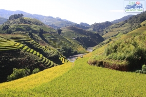
The topography is combined by mountains and narrow valleys
CLIMATE
The annual average temperature varies between 23 and 25ºC.
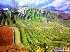
TOURISM
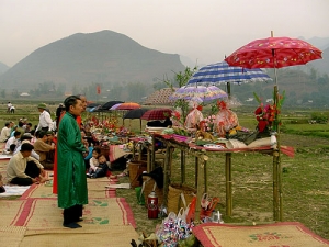
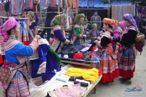
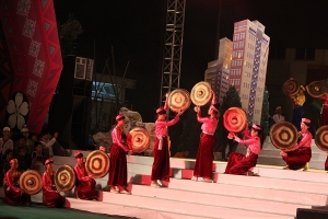
The culture of Hoa Binh combines several ethnic groups with their own languages, traditional literature, and festivals.
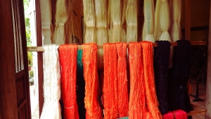
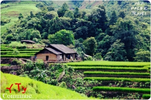
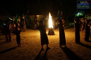
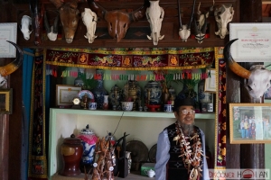
Tourists especially enjoy the ethnic specialty dishes including rice cooked in bamboo and grilled meat. At night, visitors can stay in stilt houses at Lac Village in Mai Chau Valley, enjoy watching traditional dancing, music performances (bronze drums, gongs), and Thai minority singing and dancing. The remote Muong, Dao, Tay minority villages draw visitors who like study the life of ethnic groups. Beautiful brocade and forest products are interesting souvenirs.
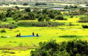
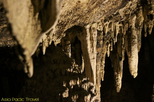
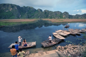
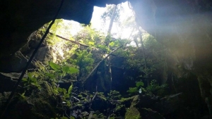
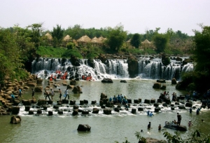
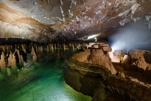
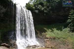
Mountainous terrain with Thac Bo, Hoa Tien grottoes, Ret Cave, Pu Nooc Primitive forest and many clean springs are suitable for swimming, climbing, walking, and hunting. Visitors are also fascinated by superb beauty of Hoa Binh Hydroelectric Power Plant, the largest one in Vietnam. Boating on Da River is an enjoyable feeling.
Apart of these, scientific tests have shown that the mineral water at Kim Boi Hot Spring is good for drinking, bathing and treatment.
TRANSPORT
Road and water transportation are convenient. There is National Highway No. 6 from Hanoi vie Ha Tay to Hoa Binh, Son La, National Highway No. 15 from Mai Chau to Thanh Hoa, National Highway No. 12B from Hoa Binh to Nho Quan (Ninh Binh).
Hoa Binh Town is 82km from Hanoi. Da River is 5km from Hoa Binh City.
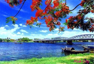
THUA THIEN HUE PROVINCE
Square: 5,063.3 km2
Population: 1090,9 thousand people (2010)
City: Hue City
Districts: Phong Dien, Quang Dien, Huong Tra, Phu Vang, Huong Thuy, Phu Loc, Nam Dong, A Luoi.
OVERVIEW
“Poetic Hue, dreamy and romantic Hue, Hue - city of two World Heritages…” are the ever names people call Hue city - the latest imperial capital of Vietnam under Nguyen dynasty (from the 17th to 19th century). Hue is located in central Vietnam on the banks of Perfume River (Sông Hương), just a few miles inland from the East Sea. It is about 700 kilometers (438 miles) south of the national capital of Hanoi and about 1100 kilometers (690 miles) north of Hochiminh City.
HISTORY
The region's history dates back some 2800 years according to archaeological findings from the Sa Huynh Culture as well as from relics in the region.
Dai Viet becomes an independent nation around 938 BC of which territorial conflict lasts for about four centuries between the Dai Viet and the Champa. The two provinces then changed their names to Thuan and Hoa. In 1307 Doan Nhu Hai was appointed by the King Tran Anh Tong to administer the area. The people from the north (Thanh Hoa) migrated south and integrated with the people of the Kingdom of Champa. During this time, had the settlement of Hoa Chau Province began, which included the area of present day Thua Thien.
Then between the period of the settlement of Thuan Hoa (1306) to the founding of Phu Xuan (1687), there were conflicts and uncertainties for the local people, which including the fall of the Tran Dynasty to the renaissance of the Ho Dynasty. Thuan Hoa and Phu Xuan started to become the location of the Dai Viet Kingdom once Nguyen Hoang was appointed head of Thuan Hoa (1511-1558). Lord Nguyen Hoang (1558-1613) established bases at Ai Tu, Tra Bat and Dinh Cat, while his Lords moved palaces to Kim Long (1636), where they would eventually base their operations in Phu Xuan (1687). The Nguyen Lords ruled the area until it taken over the the Trinh clan in 1775.
The farmers movement led by the Tay Son brothers gained momentum in 1771. The Tay Son insurgent army won the battle in Phu Xuan to take over the Nyugen capital in 1786, where they continued north and overthrew the Trinh Dynasty.
In Phu Xuan, Nguyen Hue appointed himself king, and with internal differences with the Tay Son Movement and the death of Nguyen Hue (1792), Nguyen Anh took advantage of the situation and took over Gia Dinh with the support of foreign forces. Nguyen Hue then attached the Tay Son Movement and took over Phu Xuan and the throne, thereby choosing the dynasty title of Gia Long (1802). Phu Xuan was again chosen as the capital of Vietnam until the August Revolution of 1945.
Prior to 1975, the province was known simply as Thừa Thiên
GEOGRAPHY
Thua Thien-Hue Province is located in Central Vietnam. It is next to Quang Tri Province to the north, Da Nang to the south, and Quang Nam Province to the south-west. This province leans up against the Truong Son mountain range and is washed by the East Sea, along its 120km seashore.
CLIMATE
The weather is submitted to tropical monsoon climate divided into four distinct seasons: fresh spring, very hot summer, mild autumn and windy, cold winter. The dry season lasts from March to August. It is hot with temperate rarely reaches to 39.5ºC. The rainy season lasts from September to February. It is quite cold with average temperature is 19.7ºC, but sometime down to 8.8ºC. In this time, it rains a lost, sometime lasts all day. If tourist would to avoid rainy, they come to Da Nang City, 108km from south of Hue. In the mountain area, the weather is cool with the annual temperature is between 9ºC and 29ºC. The most convenient time to visit the area is from November to April.
TOURISM
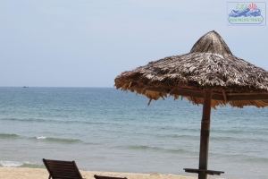
Thua Thien-Hue offers very diversified and beautiful landscapes. Nature and human beings create a harmoniously beauty with Bach Ma (White Horse) National Park and other attractive beaches such as Thuan An, Lang Co and Canh Duong.
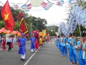
The province provides a well-balanced blend of royal heritage and folk culture. As a matter of fact, tourists discover dozens of handicraft villages, with annual festivals that are painstakingly organized.
Hue is also an important center of Buddhism. In Hue and its surrounding still exist tens of pagodas constructed more 300 years ago, and hundred of temples and pagodas built in the early 20th century.
Besides, tourist is able to enjoy many traditional famous dishes and find out about sophisticated handicraft here.

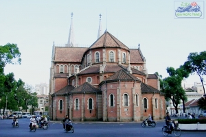
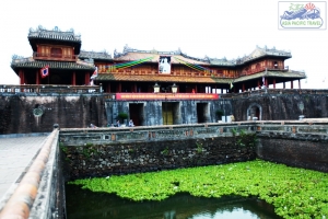
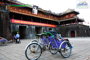
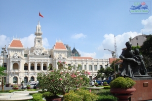
Hue Citadel - Thua Thien Hue Province
Hue Citadel has been recognized as a World Cultural Heritage Site by UNESCO since December 1993, Hue Royal Musical (Nha nhac) has been declared as a World Intangible Cultural Heritage since November 2003.
TRANSPORT
Transportation by train, road, air and water routes is very convenient.
By Road: Thua Thien-Hue Province is 654km from Hanoi, 1,051km from Ho Chi Minh City, 85km from Da Nang. The province has the National Highway 14 that links Hue with Central Highlands. It is also on the National Highway 1A that connects Hanoi and Ca Mau.
By Train: The Thong Nhat Express trains from Hanoi to Ho Chi Minh stop at Hue Railway station. The local trains come to some other provinces.
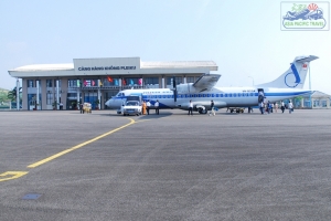
By Air: Phu Bai Airport serves flights: Hue - Ho Chi Minh City and Hue - Hanoi
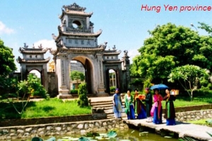
HUNG YEN PROVINCE
Square: 923.5 km2.
Population: 1132,3 thousand people (2010)
City: Hung Yen City
Districts: My Hao, Van Lam, Yen My, Khoai Chau, Van Giang, An Thi, Kim Dong, Phu Cu, Tien Lu.
OVERVIEW
The famous site in Hung Yen is Pho Hien relic group, including Van Mieu, Hien, Chuong pagodas, Mau Temple. Other popular sites are Kim Chung, Huong Lang, Thai Lac, Ne Chau pagodas, Chu Dong Tu, Phuong Hoang, Dau An, Da Hoa temples. Hung Yen is home of famous people like Nguyen Binh, Hoang Hoa Tham, Doan Thi Diem, Le Huu Trac, Chu Manh Trinh, Vu Trong Phung, Nguyen Cong Hoan, To Ngoc Van, Pham Huy Thong.
HISTORY
The area of the province of Hưng Yên has been inhabited for millennia.
During the legendary Hưng Kings period, Hung Yen belonged to Giao Chi area, Du Chien district. Under the Ngô Dynasty, it was called Dang Chau. It was then renamed Thai Binh phu (phu is an administrative unit) under the Early Lê Dynasty, Dang Chau and Khoai Chau phu under the Lý Dynasty and Long Hung lo (lo is an administrative unit) and Khoai lo under the Trần Dynasty. Under the Later Lê Dynasty, Hung Yen belonged to Son Nam and then divided into Son Nam Thuong lo and Son Nam Ha lo.
The Nguyễn Dynasty implemented administrative reforms in 1831 to dismantle the tran administrative units and establish provinces. Five districts of Dong Yen, Kim Dong, Thien Thi, Phu Cu and Tien Lu were separated from Khoai Chau phu of Son Nam Thuong tran and three districts of Than Khe, Duyen Ha and Hung Nhan were separated from Tien Hung phu of Nam Dinh tran of lower Son Nam town to establish Hung Yen province. The initial center of the province was located in An Vu and Luong Dien communes and then moved to Nhi Tan of Xich Dang commune (now Hung Yen city).
This area has favourable transport conditions with communes and markets lying side by side, enabling trading activities to be busier and busier. The Chronicle of Hung yen province stated: "The streets are very busy and bustle, crowded with vehicles; the old images of Phổ Hiền in Son Nam can been seen now in this land".
GEOGRAPHY
Located in center of Red River Delta, Hung Yen shares border with Bac Ninh Province on the north, Ha Nam Province on the south, Hai Duong, Thai Binh provinces on the east, Ha Tay Province and Hanoi on the west.
Terrain in Hung Yen is quite event and flat with many rivers. Hong, Luoc, Cuu An, Ke Sat rivers surrounds three sides of province. In addition of that, there are Kim Nguu, Nghia Ly, and Bac Hung Hai rivers.
CLIMATE
Hung Yen belongs to monsoon - tropical climate area. There are clearly two seasons: the hot and the cold seasons. Cold season is dry, from November to April next year. In hot season, it rains a lot from May to October. The annual average temperature is about 23ºC
TOURISM
The famous site in Hung Yen is Pho Hien relic group, including Van Mieu, Hien, Chuong pagodas, Mau Temple. Other popular sites are Kim Chung, Huong Lang, Thai Lac, Ne Chau pagodas, Chu Dong Tu, Phuong Hoang, Dau An, Da Hoa temples.
Hung Yen is home of famous people like Nguyen Binh, Hoang Hoa Tham, Doan Thi Diem, Le Huu Trac, Chu Manh Trinh, Vu Trong Phung, Nguyen Cong Hoan, To Ngoc Van, Pham Huy Thong.
Coming to there, visitors enjoy traditional songs such as cheo, a dao, trong quan or take part in Chu Dong Tu, Tu Phap, An Xa Village, Ghenh Temple, Co Le, Tho Hoang hamlets festivals.
Especially, Hung Yen's cape-longan is very well-known. This sweet longan with a thick pulp and a thin peel, used to be offered to kings only.
TRANSPORT
Hung Yen Town is 60km from Hanoi. Hung Yen locates on National Highway No.5: Hanoi - Hung Yen - Hai Duong - Hai Phong.
There is National Highway No.39 linking from My Hao District to Hung Yen Town and then Thai Binh. National Highway No.38 connects to Bac Ninh.
Hanoi - Hai Phong railway also comes over Hung Yen.
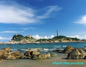
KHANH HOA PROVINCE
Square: 5,217.6 km2
Population: 1167,7 thousand people (2010)
City: Nha Trang City, Cam Ranh City
Districts: Van Ninh, Ninh Hoa, Dien Khanh, Khanh Vinh, Khanh Son, Truong Sa, Cam Lam.
OVERVIEW
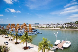
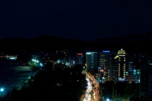
Khanh Hoa is a South Central Coastal province of Vietnam. It is well known by the attractive beauty of its own capital – Nha Trang. Among its 3 bays, Nha Trang ranks first thanks to 100% pristine beaches, excellent view, gorgeous islands, mountains, and rivers.
HISTORY
The site of what is now Khánh Hòa had been within the territory of the Champa Kingdom before it was annexed to Đại Việt's (Viet Nam's) territory. In 1653, one of the Nguyễn lords, Nguyễn Phúc Tần, sent his troops to occupy Phan Rang. The Champa king Bà Tấm surrendered to Nguyen's troops and ceded an area from the east of the Phan Rang River to Phú Yên to the Nguyễn lord. The Nguyễn lord accepted the ceded territory and set up the Thái Khang garrison and divided it into two districts: Thái Khang and Diên Ninh.
In 1832, under the rule of emperor Minh Mạng, this area was renamed Khánh Hòa and was divided into two districts which included four counties: Phủ Diên Khánh inclusive of Phước Điền and Vĩnh Xương county; Phủ Ninh Hòa inclusive of Quảng Phước and Tân Định county.
Under French Indochina, the provincial capital was located in Diên Khánh Citadel, but it was relocated in Nha Trang Town in 1945.
After the communists' victory and the Fall of Saigon on April 30, 1975, the united government merged two provinces, Phú Yên and Khánh Hòa, into Phú Khánh Province on 29 October 1975. In 1977, Nha Trang Town was upgraded to city status. In 1982, the National Assembly decided to incorporate the Spratly Islands into Phú Khánh Province. On June 30, 1989, the National Assembly reversed its previous decision and split Phú Khánh Province into two provinces as they were before.
GEOGRAPHY
Khanh Hoa Province is a coastal province of South Central Vietnam. To the north, it borders on Phu Yen Province, to the west, on Dak Lak and Lam Dong provinces, and to the south, on Ninh Thuan Province. The Khanh Hoa coast is 200km long, with more than 200 islands offshore, of which Truong Sa District gathers over one hundred islands around. The two largest rivers flowing through the province are the Cai and Danh rivers. Khanh Hoa represents one of the deepest seas in Vietnam, adjoining open oceans and international marine routes. With ragged seashore spreading out around 200km long, it contains various well-known bays, such as Cam Ranh, Van Phong and Nha Trang. Cam Ranh Bay is considered as one of three harbors that have the best natural conditions over the world. Having the area of over 60 square kilometers and the 18-20m average depth, this bay is out of the wind as a result of being surrounded by many mountain ranges. Van Phong Bay has a wonderful nature, temperate climate, idyllic beach with mostly fine sand, surrounded by hills, mountains and tropical forests, colorful coral reefs, several vestige of salt-watered forest, specific and valuable sea creatures, which is endowed with an ideal environment. These are great potentials for the development of ecological tourism in Van Phong.
CLIMATE
Khanh Hoa has a tropical monsoon climate with an average temperature of 26.5ºC. The rain season lasts 4 months (from September to December). But for the region around Nha Trang City, the rainy season lasts only 2 months, thus providing very favorable conditions to develop a long-lasted tourism season and organize year-round tourist activities. Particularly, on the Hon Ba Mountain (30km from Nha Trang), the climate likes in Da Lat and Sapa.
TOURISM
Khanh Hoa has been deeply marked by the strong ancient culture of the Cham. Until today, Champa Kingdom has left an invaluable inheritance of ruins and historical sites to visit. Khanh Hoa is endowed with beautiful natural sites and sand beaches. Visitors will enjoy the group of five or six islands situated close to each other. The largest of the islands is Hon Tre, which is located 3km from Nha Trang.

Nha Trang Ocean - Khanh Hoa Province
The city of Nha Trang has long been renowned for being a sea resort with plenty of historical vestiges and wonderful sceneries: Cham Po Nagar Towers, Long Son Pagoda, Ba Vu Mausoleum, Bao Dai Palace, Hon Chong, Hon Yen, Tri Nguyen Fish Pond, Bai Tru, Suoi Tien, Dai Lanh Beach... and many islets offshore. Nha Trang Bay has been recognized as one of 29 most beautiful bays in the word since 7/2003.The population mainly constitutes Kinh people, as well as a small percentage of Ra Glai, Tay, Nung, Muong, and Cham.
TRANSPORT
Various forms of convenient transports are available.
- Road: The National Highway 1A and the railway from north to south run through Khanh Hoa Province, linking it with the other provinces in the North and South. The National Highway 26 links Khanh Hoa to some provinces in the Central Highland. Nha Trang is 105km from Phan Rang, 190km from Buon Ma Thuot, 205km from Da Lat, 238km from Quy Nhon, 441km from Ho Chi Minh City, and 1,278km from Hanoi.
- Airlines: Nha Trang Airport is 5km from the center of the city. Vietnam Airlines offers daily connections with Ho Chi Minh City and Hanoi, and four connections a week with Da Nang. Cam Ranh Airport is 35km south of Nha Trang has flights from Hanoi, Ho Chi Minh City and Da Nang to there.
- Train: Regular connections between Hanoi and Ho Chi Minh City all stop in Nha Trang, daily train between Ho Chi Minh City and Nha Trang.
- Bus: There are connections with Da Nang, Ho Chi Minh City, Hue, Vinh, Pleiku... Minibus for Hoi An, Hue, and Da Lat...
- Water: Cam Ranh and Nha Trang ports connect Khanh Hoa with many regions in Vietnam as well as with abroad.
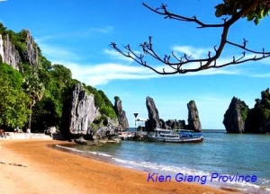
KIEN GIANG PROVINCE
Square: 6346,3 km2
Population: 1703,5 thousands people (2010)
City: Rach Gia City
Districts: Kien Luong, Hon Dat, Tan Hiep, Chau Thanh, Giong Rieng, Go Quao, An Bien, An Minh, Vinh Thuan, Phu Quoc, Kien Hai, U Minh Thuong.
OVERVIEW
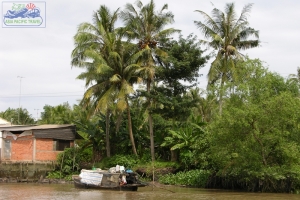
Located in the Mekong Delta, Kien Giang has a convenient location and a great economic potential. The area of the province is 6296 square kilometers with a 200 km long coastline and 105 small and big islands, of which the largest one is Phu Quoc Island. Kien Giang has a population of 1,726,026 people distributed in 16 administrative units, districts, towns and cities.
GEOGRAPHY
Kien Giang is on the Mekong Delta. It is bounded by An Giang, Hau Giang provinces, Can Tho City in the east and the south - east, Ca Mau Province in the south, and Cambodia in the north.
Kien Giang has 200km of coastline with large fishing grounds, consisting of 105 big and small islands, of which 43 islands have residents. This creates favorable conditions and good environment for raising many sorts of aquaculture.
CLIMATE
Kien Giang locates on humid monsoon tropical area. The weather is always warm with few natural calamities and abundant of sunshine. The average temperature is 27ºC. It is highest in April (29ºC) and lowest in January (25.6ºC). There are two separated seasons: the rainy season is from April to November, the dry season is from December to April.
TOURISM
Kien Giang has plains, fertile rice fields, forests of cajuput and mangrove. Kien Giang coastal area has been determined as a key fishing ground. The sea here is rich of good fishes such as mackerel, shark, blue fish, carp, shrimp. Phu Quoc's high quality fish sauce is well-known in Vietnam and abroad. This fish sauce smells particularly good since it is made from a small fish, ca com, with a high level of protein.
Kien Giang is proud of historic sites in U Minh Forest, Hon Dat, Ha Tien, Phu Quoc. The province is favored by nature with landscapes like Ha Tien, and Phu Quoc, in which Ha Tien is plentiful attractive sites of caves, pagodas, tombs, islets along the coast and offshore.
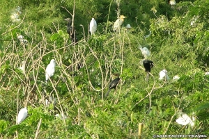
Other famous sites include the Temple and Tomb of national hero Nguyen Trung Truc in Rach Gia, Tam Bao Pagoda, the Bird Sanctuary, Tan Hoi Pagoda, and Mac Cuu Tomb.
TRANSPORT
By Road: Rach Gia is 92km from Ha Tien, 116km from Cantho, 182km from My Tho, and 250km from Ho Chi Minh City.
By Air: The province owns 3 airports: Rach Gia, Phu Quoc, and Ha Tien. From Ho Chi Minh City, there are daily flights connecting to Rach Gia, and 28 flights a week linking to Phu Quoc.
Hydrofoil boats daily connects Rach Gia and Phu Quoc and vice versa.
KON TUM PROVINCE
Square: 9,690.5 km2.
Population: 443,4 thousand people (2010)
City: Kon Tum City
Districts: Dak Glei, Ngoc Hoi, Dak To, Kon Ray, Kon Plong, Dak Ha, Tu Mo Rong, Sa Thay.
OVERVIEW
Coming to Kontum, visitors enjoy mountainous landscapes like Ngok Linh Mountain, Chu Mon Ray Primitive Forest, Dak Tre Tourist Site, and Dak To Hot Spring. Tourists are interesting in historical relics such as Kontum Former Prison, Dak Glei Prison, Ho Chi Minh Trail, Dak To, Tan Canh Battle Field.
HISTORY
The name Kon Tum comes from the name of a village of the Bahnar ethnic group. In the Bahnar language, kon means "village" and tum means "pool". Prior to the adoption of quốc ngữ, the name was rendered in Hán tự (Sino-Vietnamese characters)
GEOGRAPHY
Kon Tum is on Central Highlands. It shares border with Laos, Cambodia on the west, Quang Nam Province on the north, Quang Ngai Province on the east and Gia Lai Province on the south.
On the north, there is highest granite mountain region in Southern Vietnam with Ngok Linh 2,598m and Ngoc Phan 2,251m. It is source of Tranh, Thu Bon, Tra Khuc, Ba rivers.
Forest covers 50% total of Kon Tum area with valuable wood, rare birds. Basalt soil is suitable to plan rubber, coffee, tea, sugar cane. The province has 26,000ha grassland that gives good condition to raise cattle.
CLIMATE
Kon Tum has feature climate of Central Highland. That is tropical monsoon one. There are two seasons. The rain season lasts from May to October. The dry season lasts from November to April next year.
Annual average temperature is 23.4ºC. Annual average rainfall is 1,884mm.
TOURISM
Coming to Kon Tum, visitors enjoy mountainous landscapes like Ngok Linh Mountain, Chu Mon Ray Primitive Forest, Dak Tre Tourist Site, and Dak To Hot Spring. Tourists are interesting in historical relics such as Kon Tum Former Prison, Dak Glei Prison, Ho Chi Minh Trail, Dak To, Tan Canh Battle Field.
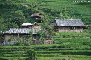
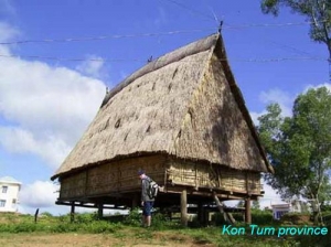
Visitors would observe beautiful wooden stilt houses in Ba Na villages and Communal House (Nha Rong) that only be found in villages on the north of the Central Highlands.
TRANSPORT
Kon Tum is 246km from Buon Ma Thuot, 215km from Quy Nhon, 49km from Pleiku. National Highway No.14 runs from west of Quang Nam, vie Kon Tum Town, then to Gia Lai, Dak Lak, Ho Chi Minh City. National Highway No.24 connects Kon Tum to Quang Ngai
LAI CHAU PROVINCE

Square: 9,562.9 km2.
Population: 382,4 thousand people (2010)
Town: Lai Chau Town.
Districts: Phong Tho, Tam Duong, Muong Te, Sin Ho, Than Uyen.
OVERVIEW
Tourists are interesting in custom of ethnic groups in Sin Ho Village or Tam Duong Townlet. They also fond of other sites such as: Tien Son Cave, Muong Lai Spring.
GEOGRAPHY
Lai Chau is situated on high mountainous region in the North West of Vietnam, northern of Da River. Its neighbors are Yunna (China) on the north, Laos on the west, Lao Cai Province on the north-east, Dien Bien, Son La provinces on the south.
A range of mountain following Northern West - Southern East makes up the terrain The Pu Sa Leng point is 3,096m in height. There are sloping mountains, hill, valley, plateau, spring alternately. Falls and waterfalls with high flow are potential of hydroelectricity in Lai Chau.
CLIMATE
Belong to tropical monsoon zone; the climate of Lai Chau is divided into two seasons: rain season and dry season. The annual average temperature is 21ºC - 23ºC.
TOURISM
Tourists are interesting in custom of ethnic groups in Sin Ho Village or Tam Duong Townlet. They also fond of other sites such as: Tien Son Cave, Muong Lai Spring.
TRANSPORT
The transportation is mainly by road. National Highway No.12 connects Dien Bien Phu City to Ma Lu Thang Border Gate crossing Lai Chau, and National Highway No.4D links Lai Chau with Sapa Townlet. Lai Chau Town is 406km from Hanoi.
LAM DONG PROVINCE
Square: 9.776,1 km2.
Population: 1204,9 thousand people (2010)
City: Da Lat City, Bao Loc City
Districts: Lac Duong, Don Duong, Duc Trong, Lam Ha, Bao Lam, Di Linh, Da Huoai, Da Teh, Cat Tien.
OVERVIEW
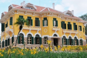
In Vietnam, Đa Lat is a popular tourist destination - highly appreciated for its temperate climate, beautiful sights such as waterfalls and lakes and its abundance of flowers and vegetables. It is the location of the Novotel Dalat (formerly Dalat Hotel) and Sofitel Dalat Palace (formerly Dalat Palace built in 1922).
GEOGRAPHY
Located in the Central Highlands region, Lam Dong is a mountainous province, and 70% of its area is covered in forest. To the north, it borders on Dak Lak and Dak Nong provinces, to the south-east, on Khanh Hoa, Ninh Thuan and Binh Thuan provinces, and to the west, on Binh Phuoc and Dong Nai provinces. The remarkable characteristic of Lam Dong's topography is the fairly distinctive division of tiers from north to south. The north of the province is high mountains, the Lang Bian plateau, with summits of altitudes between 1,300m - above 2,000m such as Bidoup (2,287m), Lang Bian (2,167m). The east and the west are mountains with modest altitudes (500m - 1,000m). The south is topographically the transition from the Di Linh - Bao Loc plateau to the semi-flat country.
CLIMATE
Lam Dong province has a tropical climate with monsoon. On the whole territory, due to a complex topography, there is a difference in elevation and degree of vegetation covering. However, the weather of Lam Dong is temperate and mild all the year round, notable changes are rare in the annual cycle. The temperature varies distinctly between areas and the higher it is, the lower temperature is. The range of the average annual temperature is 16ºC - 23ºC. Dry season is from December to March next year. Rainy season is from April to November. It is always sunny everyday. The annual rainfall is not distributed equally in time and place. Its range is 1,600 - 2,700mm. The side of the area towards the southwest wind (Bao Loc Town) has a high annual rainfall amounting to 3,771mm.
TOURISM
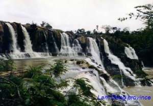
The unique tourism of Lam Dong Province is made from the combination of topographical, climatic and hydrographical factors. Together with its forests and regional flora and fauna, Lam Dong offers distinctive scenery with many picturesque lakes, falls, hills and pine forests. Some of the natural scenic spots include Xuan Huong Lake, Dan Kia - Suoi Vang Lake, Tuyen Lam Lake, Lake of Sighs, Valley of Love, Da Nhim Lake, Camly Falls, Datanla Falls, Prenn Falls, Pongour Falls, Dambri Falls, Bobla Falls, Liliang Falls, Voi (Elephant) Falls, Ponguar Falls, Golf Hills, Lang Bian Mountain, etc. Places of historical and cultural interest include some French style palaces, Linh Son Pagoda, Linh Phong Pagoda, Truc Lam Zen Monastery, Da Lat Cathedral, Cat Tien archaeological site.
 Da Lat City - Lam Dong Province
Da Lat, capital of Lam Dong Province, exhales its own poetic and romantic charm. Situated at 1,500m above sea level, Da Lat has a cool climate. The annual average temperature is 18ºC. It is also famous for its lakes, waterfalls, pine-tree forests, vegetable gardens and flowers such as rhododendron, cherry, mimosa, hydrangea, rose, daisy, and dahlia. Da Lat offers a harmonious combination of natural scenery and historical sites.
TRANSPORT
Road: Da Lat is 110km from Phan Rang (Ninh Thuan), 200km from Buon Ma Thuot (Dak Lak), 205km from Nha Trang (Khanh Hoa), 293km from Ho Chi Minh City, and 1,481km from Hanoi.
Airlines: Lien Khuong Airport is 30km south of Da Lat. There are daily flights to Ho Chi Minh City and Hanoi, and two flights a week to Da Nang
LANG SON PROVINCE
Square: 8,331.2 km2
Population: 735,600 people (2010)
City: Lang Son City.
Districts: Trang Dinh, Van Lang, Van Quan, Binh Gia, Bac Son, Huu Lung, Chi Lang, Cao Loc, Loc Binh, Dinh Lap.
OVERVIEW
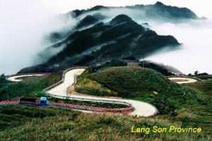
Lang Son is a northeastern province which is located on the Sino-Vietnamese border over a stretch of 253km. The capital of Lang Son, 500m above sea level, is situated on the left bank of Ky Cung River. Opposite the town and on the far side of the river is Ky Lua Market. The market is accessible by means of the Ky Cung bridge. Standing on the bridge, visitors can see a high mountain peak resembling a woman with a baby in her hands.
HISTORY
History of the province is the history of Lang Son town. Ancient history is traced to the Bronze Age. This period is marked by the trade route that existed between China and India that passed from the Red River Delta through Nanning to Guangzhou. 7000–9000 years ago the limestone caves of the province were inhabited by early settlers of the Bac Son culture.
The Dinh kings (968-980) encouraged the growth of trade in the region and requested to the Sung emperors of China that they establish trade relations at Yong Zhou.The Chinese Annals have revealed that the Vietnamese trades perfumes, elephant ivories, rhinocerous horns, gold, silver and salt in return for Chinese fabrics. Later, under the ly Dynasty an extensive market was established at Vinh Binh on the Ky Cung River.
During the reign of the Ming Dynasty, during the period 1527 and 1592, Lang Son was vastly fortified in view of its strategic importance at the border, which are seen even now; a citadel of this dynasty is located to the west of the Lang Son town on a lime stone rock outcrop.
Lạng Sơn was one of the 13 original provinces in northern Vietnam that were created under the reign of Emperor Minh Mạng in 1831; since the establishment of the Nguyen Dynasty in 1802 until then, northern Vietnam had been under the rule of a viceroy.
GEOGRAPHY
Lang Son is a frontier mountainous province in the North-East of Vietnam. It shares border with Cao Bang Province on the south, Bac Giang Province on the north, Guangxi (China) on the east, Quang Ninh Province on the north-east and Bac Kan, Thai Nguyen provinces on the west.
Mountains and hills cover over 80% of the province's total area. The complex network of rivers makes a good condition for agriculture. Main rivers that run through the province are: Ky Cung, Ba Thin, Bac Giang, Bac Khe, Thuong, Hoa, and Trung rivers.
Lang Son has two international border gates including Dong Dang railway border gate and Huu Nghi road border gate, two national border gates such as Chi Ma (in Loc Binh District) and Binh Nghi (in Trang Dinh District)... So Lang Son has an important strategic position in the North-East of Vietnam.
CLIMATE
The climate is cool and temperate. Annual average temperature is 21.5ºC. Annual average rainfall is from 1200mm to 1600mm.
TOURISM
Lang Son has potentiality of mineral, forestry, tourism and trading. Star aniseed (hoa hoi) is a specialty. The province is proud of many culture and historical vestiges. They are Rampart of Mac Dynasty, Doan Citadel Vestige, Chi Lang Defile, Ky Cung and Bac Le temples. Apart of these, Ky Lua Market, To Thi and Mau Son mountains, Tam Thanh, and Nhi Thanh grottoes also attract many visitors every year. Especially, lots of people come to Ky Lua and Tam Thanh markets to shopping because the goods are abundant and cheap.
Coming to there, tourists are interesting in Ky Lua or Long Tong traditional festivals. They would like to taste special dishes: roast duck, roast pig, Mau Son wine and lam rice.
TRANSPORT
Lang Son is 154km from Hanoi, 60km from Thai Nguyen, 48km from Quang Ninh, 55km from Cao Bang, 73km from Bac Kan.
Road: National highway routes on the territory of Lang Son province:
- No.1A: It departs from Huu Nghi Quan (Friendship Gate) and runs through Lang Son Province to Hanoi.
- No.1B: between Lang Son and Thai Nguyen.
- No.4B: between Lang Son and Cao Bang.
- No.4A: from Lang Son to Mong Cai Town of Quang Ninh Province via Tien Yen Townlet.
- No.31: between Dinh Lap and Bac Giang
- No.279: Binh Gia of Lang Son Province to Bac Kan.
Train: Hanoi-China international railway line with over 100km runs through Lang Son
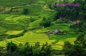
LAO CAI PROVINCE
Square: 6,383.9 km2.
Population: 626,2 thousands people (2010)
City: Lao Cai City.
Districts: Muong Khuong, Bat Xat, Bac Ha, Bao Thang, Sapa, Bao Yen, Van Ban, Si Ma Cai.
OVERVIEW
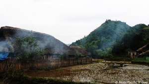
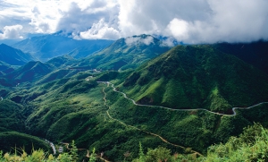
Lao Cai is one of several provinces situated on the Sino-Vietnamese border. Topography of Lao Cai is diversified with rivers, high mountain peaks, steep and high mountain passes, deep streams and wide valleys.
HISTORY
Lao Cai has been known since ancient times as a historic trading post. Here, the Chinese, the Vietnamese and the ethnic minorities of the region fought to gain control of the region. In 1463, the Viet Kings established Lao Cai as the capital of their northern most region, then named as Hung Hoa. It came under French colonial rule in 1889 and was their administrative town, and also served as a military garrison. In the early 19th century the first railway line was built from Hanoi to this region. It took 7 years to complete but at the cost of 25,000 lives of Vietnamese conscripted labour.
In late 1978, the Vietnamese invaded Cambodia. In retaliation, the Chinese, as allies of Cambodia, countered and invaded North Vietnam with the sole aim of “teaching the Vietnamese a lesson”. The attack was launched by 60,000 strong Chinese Army from several fronts. They occupied territory from Paso (previously known as Phon Tho) in the Northwest to Cao Bang and Lang Son in the Northeast. The Chinese were ill prepared for such a massive campaign, and within two weeks their attack crumbled, they lost 20,000 troops and withdrew from Vietnam but still boasting that they had won the battle. The Vietnamese had won a decisive battle on all fronts. It has been inferred that the border town, 295 km from Hanoi, with good rail, road and river traffic provided the impetus to the invaders to threaten Hanoi and the Red River Valley and that the "attacks here were intended as distractions to prevent their Vietnamese defenders from moving to reinforce the defense of Lao Cai.
GEOGRAPHY
Located in North-West Vietnam, Lao Cai is surrounded by Yunna (China) on the north, Lai Chau Province on the west, Ha Giang Province on the east and Yen Bai, Son La provinces on the south.
Lao Cai's terrain is divided into main kinds following: valley, low and high mountainous. With 3,143m in height, Fansipan is considered the highest peak of the Indochina Peninsula. The province has 107 rivers including Red, Chay and Nam Mu rivers... The province also owns 31 types of mineral, of which apatit, cooper, iron are most valuable.
The remarkable feature of Lao Cai is biologic diversification. There are 2,000 kinds of flora, 442 kinds of birds and animals... of which 60 kinds of animals only found in Lao Cai, 9 kinds of floras only found in Sapa. So that Lao Cai owns a treasure of valuable and rare genes, making up 50% rare floras in Vietnam.
CLIMATE
Lao Cai has typical mountainous climate. The dry season lasts from October to March, it is cold. And the rain season is from April to September. Annual average temperature is 23ºC. Specially, sometime, there is snow in Sapa.
TOURISM
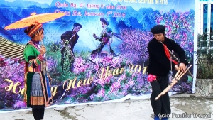
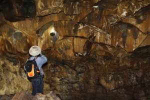
Lao Cai preserves lots of special cultural and historical sites. Outstanding vestiges is ancient stone engrave area with picture of map, handwriting, people thousand years ago in Muong Hoa Valley (Sapa), Pho Rang vestige. There are many beautiful caves like Thuy Tien (Bat Xat), Ta Phoi (Cam Duong), Tien-Trung Do (Bac Ha), Xuan Quang (Bao Thang).
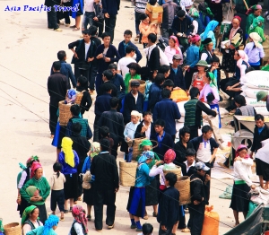
Lao Cai is very proud of Sapa, a unique natural tourist site. Many new married couples like spending their honeymoon in Sapa because of good weather and romantic sightseeing. Visitors to Sapa in summer can feel the climate of four seasons in one day. They enjoy discovering other interesting places including Ham Rong Mountain, Silver Waterfall, Rattan Bridge, Bamboo forest, Ta Phin Cave and Sapa ancient rock field. Taken place every Saturday night, Sapa Market is an attractive place for visitors who are keen on exploring traditional cultures.
In addition, Bac Ha Market hosts the biggest fair near the mountainous highlands. It is a typical weekly activity for the H'Mong and other minority groups living in the locality. In Cat Cat Village many H'Mong residents are good at manipulating gold and silver jewelry.
It is festinate to travel from Lai Chau to Lao Cai following National Highway No. 4D because of scenery along roadsides and impressive sight of Hoang Lien Son Range. This way attracts to people liking the adventure and discover on bicycle, too.
TRANSPORT
Located 300km from Hanoi, Lao Cai can be reached by car or train. There is National Highway No.70, 279, 4D linking Lao Cai to Yen Bai, Lai Chau and Ha Giang, China in turn. There are some trains depart from Hanoi daily to Lao Cai.