

Asia Pacific Travel Team
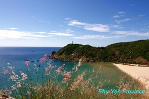
PHU YEN PROVINCE
Square: 5,060.6 km2.
Population: 868,500 people (2010)
City: Tuy Hoa City.
Districts: Dong Xuan, Song Cau, Tuy An, Son Hoa, Tay Hoa, Dong Hoa, Song Hinh, Phu Hoa.
OVERVIEW
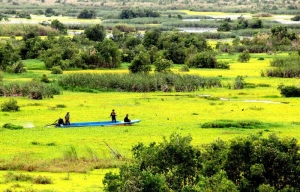
Phu Yen is naturally endowed with a nearly 200km coastline and a great many gulfs, lagoons, beaches and islets. The province also has rivers, mountains, lakes, hot spa areas and valuable tangible and intangible cultural heritage sites. These are ideal conditions for the province’s tourism industry to take off. Coming to the province, visitors will have a chance to get close to nature and discover the distinctive culture of the people of Phu Yen.
GEOGRAPHY
Situated in South-Central Coast, Phu Yen shares border with Binh Dinh Province on the north, Khanh Hoa Province on the south, Dak Lak and Gia Lai provinces on the west and East Sea on the east.
The terrain is divided into two main area including mountain, hill, plain and more than 100km seaside.
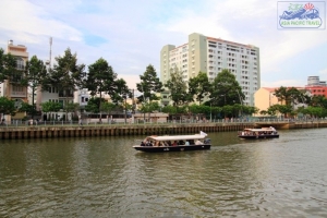
Phu Yen has a quite diversified resources of land, forest, sea, rivers, lagoons, bays such as Cu Mong, Xuan Dai bays, O Loan, Vung Ro lagoons, Ba, Ky Lo, and Ban Thach rivers. Phu Yen owns Da Rang Bridge, the longest one in Central Vietnam
CLIMATE
Influenced by ocean climate, the weather here is hot with high humid and lots of rain. Annual average temperature is 26.5ºC.
TOURISM
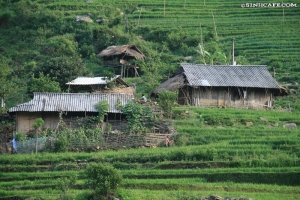
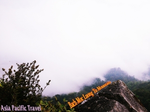
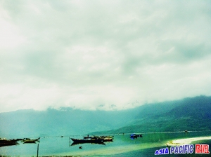
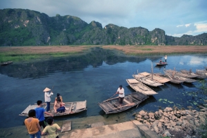
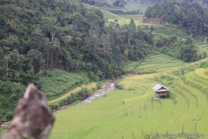
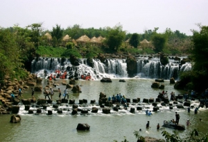
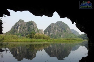
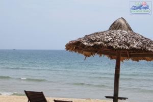
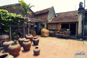
Phu Yen has beautiful landscapes following: Nhan Tower on the northern bank of the Da Rang River. This was a place of worship for the Cham people dated in the late 11th to the early 12th centuries. On the north, visitors are able to swim in My A Beach (Long Thuy), an incredibly beautiful beach with white sand and clear water under the shadows of coconut trees, or discover O Loan lagoon, Hon Chua, Hon Yen islands, Tien Beach, Da Trang Pagoda, and discover Da Dia Rapids with special 35,000 stone columns.
On the south, there are Vung Ro Port, Ro Bay and Bac Deo Ca Natural Preservation that has rich of flora and fauna. The west of Phu Yen is Krong Trai National Preservation and Go Thi Thung Vestige. The most famous seafood dish form in this area is grilled blood clam.
TRANSPORT
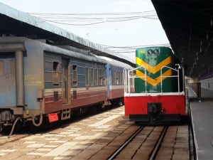
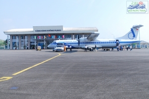
Tuy Hoa City is 120km from Nha Trang, and 561km from Ho Chi Minh City and 1,156km from Hanoi. National Highway No.1A and North-South Express Train run throw the province and stop at Tuy Hoa City. There are two flights a week from Ho Chi Minh City to Tuy Hoa Airport .
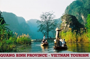
QUANG BINH PROVINCE
Square: 8065,3 km2
Population: 849,3 thousands people (2010)
City: Dong Hoi City
Districts: Tuyen Hoa, Minh Hoa, Quang Trach, Bo Trach, Quang Ninh, Le Thuy.
OVERVIEW:
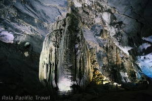
This province is home to the World Heritage Phong Nha-Ke Bang National Park. The province is also home to several famous Vietnamese persons, including general Vo Nguyen Giap, the family of former South Vietnamese president Ngo Dinh Diem, poet Han Mac Tu, and writer Bao Ninh.
HISTORY:
For a long time in history, this region belonged to Văn Lang and then kingdom of Champa and then a conflicted territory between Viet the Great and Champa, it was officially annexed into Đại Việt by Lý Thường Kiệt, a general of Lý Dynasty (under the reign of Lý king Lý Thánh Tông). The site of the present Quang Binh was battlefields between Champa and Vietnam until the Vietnamese territory was expanded farther south in the following dynasties. Quang Binh emerged its importance since Nguyễn Hoàng, a prince of Nguyễn Lords was sent by Lê king to the south. He developed his manor and turned it into a strong state Dang Trong, a rival of de facto Trịnh-controlled Dang Ngoai. Quang Binh under Nguyễn Lords became an important front to defence Dang Trong from Dang Ngoai's attack. Under the French rule, this province was part of An Nam. During the Vietnam War, this province was part of communist-controlled Democratic Republic of Vietnam or North Vietnam, only 20 km from the DMZ. This province was severely devastated by bombing from U.S. B-52s.
GEOGRAPHY:
Located in North-Central Vietnam, Quang Binh Province is surrounded by Ha Tinh Province on the north, East Sea on the east, Laos on the west and Quang Tri Province on the south.
The provincial topography is narrow and sloping from the west to the east. The area is divided into specific geological zones: mountainous, hilly and midland, lowland, coastal sandy area. The seaside stretches 116km with large Gianh and Nhat Le ports.
CLIMATE:
Quang Binh belongs to the monsoon-tropical zone. The climate is divided into two seasons. Rainy season lasts from September to March next year. The annual average rainfall is 2,000-2,300mm. Heavy rains concentrate in September, October and November. Dry season lasts from April to August. Annual average degree is 24ºC-26ºC.
TOURISM:
Quang Binh is famous for many charming landscape of mountain and sea. The coast is dotted with blue water, yellow sand beaches that sparkle under forests of green willow trees.
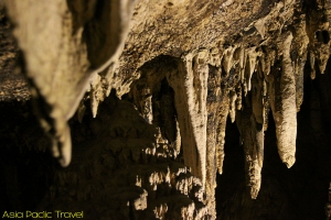
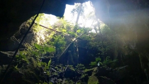
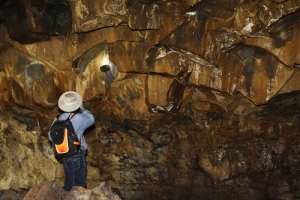
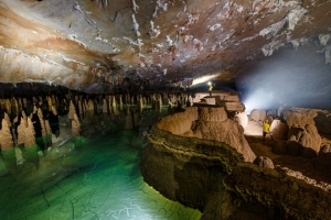
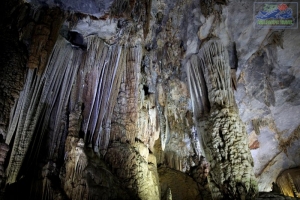
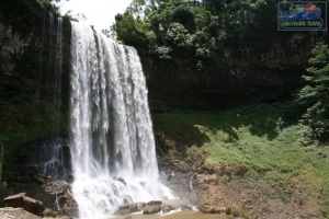
Every year, Quang Binh attracts many visitors coming to interesting landscapes such as Phong Nha, Tien Son caves, primitive forest in Phong Nha - Ke Bang reserve, Nhat Le, Da Nhay beaches, Bang Mineral Hot Spring, etc. Among of them, Phong Nha - Ke Bang National Park has been recognized as the World Natural Heritage Site by UNESCO in 2003.
In addition of these, Quang Binh preserves objects from Bau Tro Remains, Hoa Binh and Dong Son culture as well as historical relics like Quang Binh Gate, Luy Thay, Rao Sen... Many places related two resistance wars name Cu Nam, Canh Duong, Cha Lo, Cong Troi, Xuan Son, Long Dai and Ho Chi Minh Trail.
TRANSPORTATION:
Road, rail and shipping routes are fairly well developed. Dong Hoi City is 491km from Hanoi, 94km from Dong Ha, 166km from Hue, and 197km from Vinh. National Highway No.1A and North-South Express Train runs throw the province and stop at Dong Hoi City. Quang Binh has Cha Lo Border Gate in Minh Hoa District to Laos.
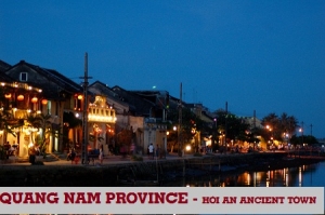
QUANG NAM PROVINCE
Square: 10438,4 km2
Population: 1425,1 thousands people (2010)
City: Hoi An City, Tam Ky City
Districts: Dai Loc, Dien Ban, Duy Xuyen, Nam Giang, Thang Binh, Que Son, Hiep Duc, Tien Phuoc, Phuoc Son, Nui Thanh, Bac Tra My, Nam Tra My, Tay Giang, Dong Giang, Phu Ninh.
OVERVIEW:
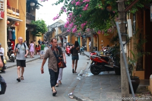
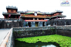
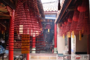
Experiencing the ups and downs over the years, Quang Nam still preserves the unique historical and cultural remains of the past along with rich human values. Some of the typical cultural sites include: Hoi An Ancient Town, My Son Holy Land, Tra Kieu Old Champa Capital, Cham Towers in Khuong My and Chien Dan, which record the remains of Sa Huynh, Champa and the Dai Viet civilization.
GEOGRAPHY:
Quang Nam is located in the middle of Central Vietnam and is surrounded by Thua Thien-Hue, Quang Ngai, and Kon Tum provinces. The Truong Son Mountains, Laos, and the East Sea also border the province.
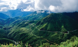
Quang Nam has various of mountains and hills (covers 72% its surface) with many high mountains such as Lum Heo Mountain of 2,045m, Tion Mountain of 2,032m, Gole - Lang Mountain of 1,855m... Main rivers run from Truong Son Range to East Sea as Vu Gia , Thu Bon, Tam Ky rivers.
CLIMATE:
Quang Nam's climate is influenced by monsoon. The annual average temperature is 25ºC. It is hot and dry from February to April and rainy from September to December. The average humidity is about 84%. The annual average rainfall is 2,000mm. The average sunny hours: 1,944 hours/years.
TOURISM:
Experiencing the ups and downs over the years, Quang Nam still preserves the unique historical and cultural remains of the past along with rich human values. Some of the typical cultural sites include: Hoi An Ancient Town, My Son Holy Land, Tra Kieu Old Champa Capital, Cham Towers in Khuong My and Chien Dan, which record the remains of Sa Huynh, Champa and the Dai Viet civilization.
During many wars, Quang Nam was one of the cradles of the revolutionary movement. Bo Bo, Nui Chua, Vinh Trinh, Cho Duoc, Chu Lai and underground tunnels of Ky Anh, the Ho Chi Minh Trail have gone down in history as the destinations for tourist to stop and visit the former battle fields.
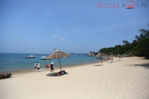
The province possesses 120km of coastline stretching form Dien Ngoc to Dung Quat with many beautiful, clean and deserted beaches. The beaches of Dien Duong, Cua Dai, Binh Minh, Tam Thanh, Ky Ha and Bai Rang together with the lake of Phu Ninh, the rivers of the Thu Bon and Truong Giang and the island of Cham are ideal tourist attractions.
Hoi An Ancient Town and My Son Cham Towers have been recognized as World Cultural Heritage since 12/1999.
TRANSPORTATION:
Quang Nam Province is located in the middle of Vietnam, 860km from Hanoi, 947km from Ho Chi Minh City, and 108km from Hue City. The province is on the National Highway 1A, the South - North railway and on the route of Da Nang - Quang Nam - Kon Tum - Gia Lai - Dak Lak - Dak Nong - Binh Phuoc. Hoi An is 32km from Da Nang and can be reached by car, bus or minibus.
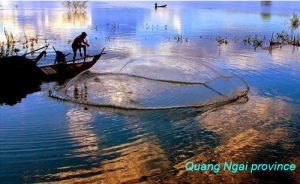
QUANG NGAI PROVINCE
Square: 5,152.7 km2.
Population: 1218,6 thousands people (2010)
City: Quang Ngai City.
Districts: Ly Son, Binh Son, Tra Bong, Son Tinh, Son Tay, Son Ha, Tu Nghia, Nghia Hanh, Minh Long, Mo Duc, Duc Pho, Ba To, Tay Tra.
OVERVIEW
Quang Ngai is located in Central Vietnam, at an almost equal distance from the two ends of the country. Like other provinces in this area, Quang Ngai is characterized as having mountains on one side and the sea on the other. The population consists of a majority of Kinh people.
HISTORY
The ancient Sa Huynh culture inhabited what is now Quang Ngai. Remains of it were found in Sa Huynh in Duc Pho District in southern Quang Ngai province. Within Champa, the region that is now Quang Ngai was less significant than its powerful neighbours to the north and south (in Quang Nam Province and Vijaya in Binh Dinh Province). There are only a few Cham remains in the province. The area became part of Vietnam together with Vijaya (Binh Dinh Province) in 1471.
In the early 19th century the Long Wall of Quang Ngai was constructed in the province. It improved security among the Vietnamese and Hre people and facilitated trade.
Quang Ngai Province has long been particularly resistant to foreign occupiers. It was one of the first provinces in central Vietnam (together with Quang Tri Province) to organize self-defence forces in March 1945, with the famous Ba To Guerilla Unit mobilizing tens of thousands of peasants.
Quảng Ngãi Province was known as an NLF (Vietcong) stronghold during the Vietnam War and was the site of the infamous Binh Hoa massacre, Dien Nien-Phuoc Binh Massacre in 1966 and My Lai Massacre in 1968, as well as Operations Malheur I and Malheur II and Operation Quyet Thang 202. It produced famous war literature on both sides of the conflict: The now-famous wartime diary of NLF medic Đặng Thùy Trâm was written here, and from an American perspective, Quảng Ngãi Province is the major setting of Tim O'Brien's The Things They Carried.
GEOGRAPHY
Located on South-Central Vietnam, Quang Ngai borders Quang Nam Province on the north, Binh Dinh Province on the south, Kon Tum Province on the west and East Sea on the east with 135km seaside.
The province is surrounded by Truong Son Mountains on one side and the East Sea on the other. As a result, the topography includes mountains, plains, seaside and offshore islands. The main rivers are Tra Khuc, Tra Bong, and Ve rivers.
CLIMATE
The rain season lasts from September to December. It is hot between April and August and the weather is cold from January to March. Annual average temperature is 26ºC.
TOURISM
Quang Ngai is famous for the cultural vestiges of Chau Sa Citadel, Ong and Mai Son pagodas. The beautiful landscapes are An Mountain, Thien An Mountain and Tra Khuc River, Co Luy Commune under coconut trees, Sa Huynh and My Khe beaches.
Sa Huynh Beach is well-known with clear water, golden sand and pine trees. My Khe Beach is the most beautiful beach in Central Vietnam. It has fine white powdery sand, gently waves and poplars forest.
Coming to there, tourists have chance to visit old battlefields with popular names like Ba To, Tra Bong, Ba Gia, Van Tuong and Son My.
TRANSPORT
Quang Ngai City is 100km from Hoi An, 131km from Da Nang, 174km from Qui Nhon, 238km from Hue, 860km from Ho Chi Minh City, and 889km from Hanoi. National Highway No.1A and North-South Express Train runs through the province. National Highway No.24A links Quang Ngai to Central Highlands and Laos.
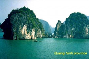
QUANG NINH PROVINCE
Square: 6099,0 km2
Population: 1159,5 thousands people (2010)
City: Halong City, Mong Cai City, Uong Bi City
Districts: Ba Che, Binh Lieu, Hai Ha, Dam Ha, Tien Yen, Van Don, Hoanh Bo, Dong Trieu, Co To, Yen Hung.
OVERVIEW
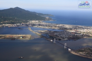
Located in the North-East of the country Quang Ninh Province has an area of more than 5 900 sq.km and a population of 1.000000. It has forests plains and sea and an international border gate of Mong Cai to the People's Republic of China.Quang Ninh has access to many land and river-going transport ways including the Cai Lan the only deep-sea port in northern Vietnam.
GEOGRAPHY
Quang Ninh is a mountainous and coastal province, with more than 80% of its area being made up of mountains and hills. The sea and island zone of Quang Ninh has a unique terrain. There are more than 2,000 islands, making up two thirds of the Vietnam's islands. They extend along the coast for more than 250km and divide into numerous layers. The largest islands are Cai Bau and Ban Sen, while the smallest are just like rocks in a garden. The sea bottom terrain of Quang Ninh isn't smooth, and 20m-average depth. There are the remnants of ancient streams and underwater rocky banks. The streams from the mainland connect to deep drains along the sea-floor; creating a series of waterways, canals and harbors along the coast.
CLIMATE
Quang Ninh's climate is symbolic of the climate in the North Vietnam; featuring all four seasons. In summer, it's hot, humid and rainy, while monsoons flourish. In winter, it's cold, dry, and sometime rainy.
The average heat radiating during a year is 115.4 Kcal/sq. cm. The average temperature is over 21ºC, while the average humidity is 84%. Annual rainfall totals between 1,700 and 2,400mm, and there can be between 90 to 170 rainy days in a year. These are mainly concentrated in the summer (more than 85%), and especially in the months of July and August. In winter, rainfall only reaches between 150 and 400mm.
In comparison to other provinces in the north, Quang Ninh has been more under the influences of north-eastern monsoons. The wind blows strongly and the temperature drops to between 1 and 3ºC. During a north-eastern monsoon, high mountainous regions such as Binh Lieu and Hai Ha, Dam Ha sometimes see the temperature drop below 0ºC.
Storms have a large influence on the province, mainly in June, July and August. The intensity can be extremely strong, especially in island and coastal regions.
Due to differences in terrain, the climate of sub-regions vary. The border area of the Mong Cai Town is colder and rainy, with an average temperature of around 22ºC and rainfall reaching 2,751mm. In the Yen Hung District, the most southern area, the average temperature is 24ºC and sees an average rainfall of 1,700mm. The high mountainous region of Hoanh Bo, and Ba Che Districts, is victim to 20 days of frost a year, and is subject to little rainfall. In the Binh Lieu District there is heavy rain (2,400mm) and winter lasts for six months. The offshore island region is not the wettest area, with only 1,700 to 1,800mm³ of rainfall per year, but winter is often accompanied by thick mists.
TOURISM
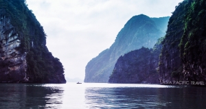
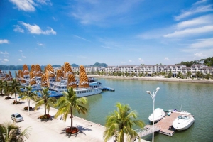
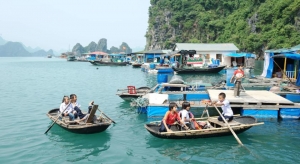
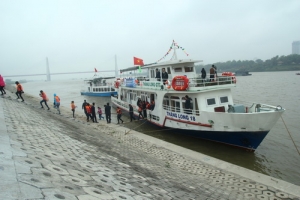
There are many beautiful beaches and natural beauty spots such as Halong Bay, Bai Tu Long Bay, Tra Co Beach, Co To Beach, Dai Beach in Van Don etc. Besides, there are historical and architectural relics enabling the development of tours on land, sea and islands.
Halong Bay covers an area of 1,553 sq. km including 1,969 islands, of which an area of over 434 sq. km including 788 islands has been recognized by UNESCO as a world heritage due to its cultural, aesthetic, bio-geological and economic value. There are in the bay many soil islands, caves, grottoes, beaches, beautiful landscapes enabling the development of attractive tourist sites of various types.

Halong Bay - Quang Ninh Province - Vietnam Tourism
Tuan Chau Island belonging to Halong Bay has an area of 220ha. It is 8km from Halong City and 2km offshore. This is an ideal spot to develop a super tourist complex. Bai Chay Beach is a wonderful spot and provides full range of services.
With around 500 historical, cultural and arts relics, attached with many traditional festivals; such as Yen Tu Pagoda, Cua Ong Temple, Bach Dang historical relic, Long Tien Pagoda, Quan Lan Communal House etc, which attract a large number of visitors, especially during festivals.
Coming to Quang Ninh, tourists can have good chance of enjoying seafood, including holothurians, abalone, shrimp, crab, areca, shellfish, gaillardia, etc
TRANSPORT
Road:
- Hanoi - Bac Ninh - Halong: 155km. This is the shortest land route from Hanoi to Halong.
- Hanoi - Hai Duong - Halong: 163km.
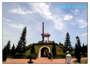
QUANG TRI PROVINCE
Square: 4747,0 km2.
Population: 600,5 thousands people (2010)
City: Dong Ha City.
Districts: Vinh Linh, Gio Linh, Cam Lo, Trieu Phong, Hai Lang, Huong Hoa, Da Krong, Con Co.
OVERVIEW
Located on North - Central Vietnam, Quang Tri is surrounded by Quang Binh Province on the north, Thua Thien-Hue Province on the south, Savanakhet (Laos)on the west, East Sea on the east with 75km seaside. Topography consists of mountains, hills, plains, sand dune and seaside. The long coast and complex network of rives includes Ben Hai, Cam Lo, Quang Tri, Thach Han… making a good condition for hydroelectricity and aquiculture.
HISTORY
In the immediate prehistorical period, the lowlands of Quang Tri and Central Vietnam as a whole were occupied by Cham peoples (Champa), speaking a Malayo-Polynesian language, and culturally distinct from the Vietnamese to the north along the Red River. The Qin conquered parts of present day Central Vietnam at the end of the 3rd century BCE, and administered the indigenous peoples of the area through a commandery, Rinan, for several centuries. A rebellion by the Cham in the 2nd century CE overthrew Chinese control and reestablished local government. 136 Beginning in the 14th and 15th centuries, the Chams were defeated in the area by Vietnamese armies, and ethnic Vietnamese gradually displaced or absorbed those Chams who had not fled. Over time a distinct Vietnamese dialectical and cultural subgroup developed in the area. The region was seized by the French by 1874 and became part of French Indochina in 1887 as the Annam protectorate.
Upon the division of Vietnam in 1954 into North and South, Quang Tri became the northernmost province of the Republic of Vietnam. Starting in 1964, the province gradually became a center for American bases, particularly after October 1966, when the 3rd Marine Division moved to bases just south of the demilitarized zone. In 1966, North Vietnamese forces also began occupying the northern region and pushing deeper into the province. The provincial capital, Quang Tri City, was overrun and occupied briefly by Communist troops in April, 1967, and was a principle battleground during the 1968 Tet Offensive when it was again overrun by North Vietnamese troops and held for a short period before being recaptured by South Vietnamese government and U.S. forces.The well known Battle of Khe Sanh (1968) was a part of the North's steady efforts to occupy the whole of the province.
After Khe Sanh was evacuated in July 1968, the North Vietnamese continued their efforts to take the entire province. The most notable achievement of the North Vietnamese offensive in 1972 was capturing Quang Tri (First Battle of Quảng Trị), though they lost much of the territory gained during the South Vietnamese counteroffensive June through September, 1972 (Second Battle of Quang Tri). With South Vietnamese forces unable to hold the province during the final North Vietnamese offensive of the war (Ho Chi Minh Campaign), the entire province fell to North Vietnamese forces in March, 1975.
After Quang Tri fell, the North Vietnamese Provisional Revolutionary Government laid its authority over the province. Collective farms were set up and strict rules instilled by the Viet Cong were forced on the villagers, many of whom eventually fled. According to Gary D. Murfin, one of the lead writers to have done a survey on Vietnamese refugees after 1975, the province was an area of particularly dense Catholic concentration, many of whom were anti-communist. He estimated that 41% fled the area in fear of Viet Cong reprisals, 37% feared fighting, shelling, and bombing, and others fled because they were a family related to a Nationalist soldier, or were at one point landowners. Today, the province is largely agricultural and rural.
The provincial capital of Quang Tri is Dong Ha. Another notable town is Quang Tri, a new settlement built across the Thach Han River from the former provincial capital, Quang Tri City, which was destroyed during the war.
GEOGRAPHY
Located on North - Central Vietnam Quang Tri is surrounded by Quang Binh Province on the north, Thua Thien-Hue Province on the south, Savanakhet (Laos)on the west, East Sea on the east with 75km seaside.
Topography consists of mountains, hills, plains, sand dune and seaside. The long coast and complex network of rives includes Ben Hai, Cam Lo, Quang Tri, Thach Han making a good condition for hydroelectricity and aquiculture.
CLIMATE
The weather condition is very severe with hot and dry south- west winds. Annual average temperature is 24ºC.
TOURISM
Quang Tri preserves many remains from the anti- American resistance war such as the ancient citadel of Quang Tri, Khe Sanh Combat Base, Truong Son National Cemetery, Vinh Moc Tunnels, Hien Luong Bridge and Ben Hai River.
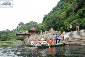
Coming to there, tourists are able to take interesting holiday in Dakrong Beauty Spot and Cua Tung Beach. The beach has sparkling clean water, silky sand and soft breeze, the whisper made by the rows of casuarinas trees. It is very pleasant to go on boat down stream on the Ben Hai River and admire the beautiful landscapes.
TRANSPORT
Dong Ha Town is 74km from Hue City, 80km from Lao Bao Border crossing, 94km from Dong Hoi (Quang Binh Province), 190km from Da Nang, 617km from Hanoi, and 1,112km from Ho Chi Minh City . National Highway No.1A runs through the province and National Highway No.9, the Trans-Asia Highway connects with the Lao Bao international border gate to Laos
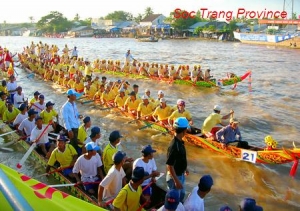
SOC TRANG PROVINCE
Square: 3.311,8 km2
Population: 1300,8 thousands people (2010)
City: Soc Trang City
Districts: Ke Sach, My Tu, My Xuyen, Thanh Tri, Long Phu, Vinh Chau, Cu Lao Dung, Nga Nam.
OVERVIEW
Soc Trang Province of Vietnam is located deep in the Mekong Delta. Soc Trang is bordered to the north and north-east by the Hau River (lower Mekong River) and Tra Vinh Province, to the north by Can Tho Province, to the north-west by Hau Giang Province, to the west and south-west by Bac Lieu Province, and to the south by the East Vietnam Sea.
GEOGRAPHY
Situated in Mekong Delta, Soc Trang is surrounded by Tra Vinh, Vinh Long, Hau Giang, Bac Lieu and East Sea. There are 72km seaside, two river mouths and 30,000ha alluvia ground.
CLIMATE
Influenced by oceanic weather, the province has two seasons: the rainy season lasts from May to November and dry season lasts from December to April next year. Annual average temperature is 27ºC. Annual rainfall is 1,840mm
TOURISM
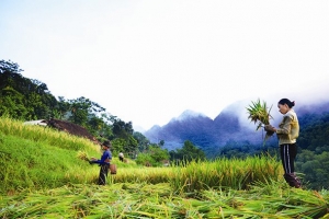
Soc Trang is covered by vast rice paddies, shrimp lagoons, luxuriant fruit gardens like longan, rambutan, durian, and orange.
Viet (Kinh), Khmer, Hoa ethnic groups live together here. The province has 89 pagodas of Khmer group, 47 pagodas of Hoa people. Ma Toc (Bat), Khleang, Chruitim Chas, Chen Kieu, and Buu Son Tu (Set) are famous pagodas.

Soc Trang Province - Vietnam Tourism
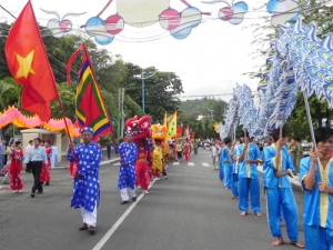
Coming to there, tourists like to taste tropical fruit in My Phuoc River Islet, or join many recreation and entertainment activities in Binh An Tourist Resort. Chol Chnam Thmay, Oc Om Boc festivals, Ngo Boat Race also attract many visitors.
TRANSPORT
Soc Trang is 231km from Ho Chi Minh City, 60km from Can Tho. National Highways No.1A links the province and Can Tho, Bac Lieu.
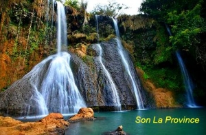
SON LA PROVINCE
Square: 14174,4 km2.
Population: 1092,7 thousands people (2010)
City: Son La City.
Districts: Quynh Nhai, Muong La, Thuan Chau, Phu Yen, Bac Yen, Mai Son, Song Ma, Yen Chau, Moc Chau, Sop Cop.
OVERVIEW
Located 320km northwest of Hanoi, Son La town is often used as a half-way overnight stop on the way to Dien Bien Phu. There is not much to remark the town except a prison built in 1908 by the French colonialists to incarcerate the Vietnamese political prisonners
GEOGRAPHY
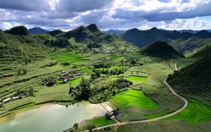
Son La belongs to North-West Vietnam, shares border with Yen Bai, Lao Cai, Lai Chau provinces on the north, Dien Bien Province on the west, Phu Tho and Hoa Binh provinces on the east and Laos on the south.
The province has many mountains, rives and mineral sources. Abundant water supply is suitable to hydroelectricity. Moc Chau Plateau is an ideal place to breed milk cow, plant tea and fruit.
CLIMATE
Annual average temperature is about 21ºC. The weather is cold, dry in winter and hot in summer
TOURISM
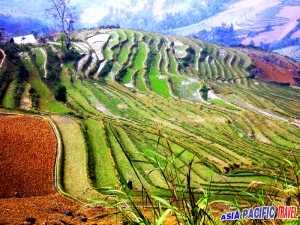
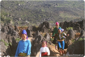
Son La owns following interesting sites. Son La Former Prison and Museum preserves revolutionary remains and exhibits precious objects introducing the historical and cultural traditions of the 12 ethnic groups living in Son La. Stretching out 150m long, Tham Tet Toong Cave is a wonder of nature. Along the walls of the cave, there are numerous stalactites and stalagmites. Ban Hin (Hin ethnic minority hamlet) is marked by the traditions and culture of the Thai. There, tourists enjoy drinking ruou can and watching xoe dance by Thai women. Then visitor like to go to Yen Chau Site to try special bananas, longans and mangoes.
In 2nd lunar month, when ban flowers begins to blossom, coloring the mountains in white, Thai ethnic group held Hoa Ban Festival. Boys and girls go flower picking to celebrate the spring and entertain themselves by singing, playing tinh and khen flute, dancing xoe.
TRANSPORT
Son La connects Hoa Binh by National Highway No. 6, Yen Bai by Highway No.37, Lao Cai by Higway No.279. Son La Town is 328km from Hanoi. In Na San Airport, Vietnam Airlines has daily flight from Hanoi to Son La.
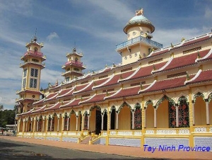
TAY NINH PROVINCE
Square: 4049,2 km2.
Population: 1075,3 thousands people (2010)
Town: Tay Ninh Town
Districts: Tan Bien, Tan Chau, Duong Minh Chau, Chau Thanh, Hoa Thanh, Ben Cau, Go Dau, Trang Bang.
OVERVIEW
Located in Eastern of the South, Tay Ninh shares border with Cambodia on the north with 240km boundary, Binh Duong and Binh Phuoc provinces on the east, Ho Chi Minh City and Long An Province on the south. On the north, there is Ba Den Mountain, 986m in height. On the south, terrain is quite flat. The province has Vam Co Dong and Sai Gon rivers and Dau Tieng Lake.
GEOGRAPHY
Located in Eastern of the South, Tay Ninh shares border with Cambodia on the north with 240km boundary, Binh Duong and Binh Phuoc provinces on the east, Ho Chi Minh City and Long An Province on the south.
On the north, there is Ba Den Mountain, 986m in height. On the south, terrain is quite flat. The province has Vam Co Dong and Sai Gon rivers and Dau Tieng Lake.
CLIMATE
The weather is hot, humid around year with annual average temperature of 27.5ºC, annual rainfall of 1,724mm. The dry season lasts from December to April and the rainy season lasts from May to November.
TOURISM
Coming to Tay Ninh, tourists are able to visit Ba Den Mountain, a famous complex of cultural and historical sites and beauty spots, and Binh Thanh Cham Tower, a monument of the Oc-Eo culture. Every year, Ba Den Mountain Festival attracts many pilgrims come to pray, sightseeing and enjoy the entertainment.
Tay Ninh is home of Cao Dai religion with Tay Ninh Cao Dai Temple, a complex of Great Temple, Chanh Mon Gate, four towers and Mother-of-Buddha Temple. The province also is base of revolution of South Vietnam during resistance against the Americans.
TRANSPORT
Tay Ninh Town is 99km from Ho Chi Minh City, 224km from Vung Tau, 129km from Bien Hoa. There are Moc Bai and Xa Mat border gates to Cambodia. Moc Bai Market is trade center of Vietnamese and Cambodian.
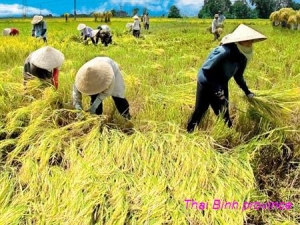
THAI BINH PROVINCE
Square: 1567,4 km2.
Population: 1786,3 thousands people (2010)
City: Thai Binh City.
Districts: Hung Ha, Quynh Phu, Thai Thuy, Dong Hung, Vu Thu, Kien Xuong, Tien Hai.
OVERVIEW
Thai Binh is a place where has historical – cultural works and folklore activities, among them some have been listed by government as Le Qui Don’s worship hall, Ho Chi Minh’s memento – house… but Keo temple is most famous. Keo temple called Than Quang temple – Viet Nam’s architecturally typical work. A whole province has brought about nearly 82 traditional festivals, 16 Vietnamese poplar operas and games as cheo, roi nuoc, bat dat, act. Beside, Thai Binh also has traditional handicraft villages famous for along time such as silver carving village of Dong Xam and An Le, Nam Cao weaving village, Minh Lang embroidering.
GEOGRAPHY
Belongs to the Red River Delta, Thai Binh is a granary of North Vietnam. The province is surrounded by Hai Duong Province and Hai Phong City on the north, Ha Nam and Hung Yen provinces on the west, East Sea on the east and Nam Dinh Province on the south.
Three faces of Thai Binh are Red, Luoc and Hoa rivers, and one face is 53km seaside and no any mountain.
The subsequent fertile soil was excellent for growing grains, especially rice. Thai Binh rice is acknowledged as the best strain in the North of Vietnam. There are 200 types of aquaculture and 2,500 kinds of rare birds, too.
CLIMATE
On monsoon tropical region, Thai Binh has cold winter (from November to April) and hot summer (from May to October). Annual average temperature is 23.5ºC, the lowest temperature is 4?C and the highest one is 38ºC. Average rainfall is from 1.400mm to 1.800mm
TOURISM
Due to its richness of aquatic products and grains, locals here have created a number of local specialties from their natural materials; among of these the most famous are Canh Ca Quynh Coi (Quynh Coi fish soup) and cay cake.
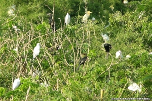
Coming to Thai Binh, tourists enjoy visiting inshore sandbanks where rare birds stops, seeing natural beauty in mangrove forest, swimming in Dong Chau Beach, and joining interesting traditional festivals. Well-known culture constructions are Dong Bang, Tien La temples, and Keo Pagoda. There are many valuable votive objects and beautiful three-storey bell tower in Keo Pagoda. Various flowers and fruits in Bach Thuan Garden Village also attract many visitors every year.
This province is rich of traditional handicraft villages like weave fabric in Phuong La, mat weave in Hoi, silver carve in Dong Xam, copper casting in An Long, lace embroider in Minh Lang, cay cake making in Nguyen Xa.
Visitors are able to enjoy many folk songs, festival games in traditional festivals such as water puppet in Nguyen Xa, cheo song in Khuoc, fish and duck catching, rice cooking competition and squib contests.
TRANSPORT
Thai Binh City is 110km from Hanoi, 70km from Hai Phong, 18km from Nam Dinh. There are Tan De, Thai Binh, and Trieu Duong bridges. National Highway No.10 connects Thai Binh, Hai Phong and Nam Dinh and National Highway No.39 links the province to Hung Yen.