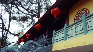


Asia Pacific Travel Team
THAI NGUYEN PROVINCE
Square: 3526,2 km2.
Population: 1131,3 thousands people (2010)
City: Thai Nguyen City.
Districts: Dinh Hoa, Dai Tu, Vo Nhai, Dong Hy, Phu Luong, Phu Binh, Pho Yen, Song Cong.
OVERVIEW
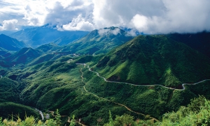
Thai Nguyen Province is located in Viet Bac, the northeastern part of the country. It is bordered by Bac Can to the north, Vinh Phuc to the south, Bac Giang and Lang Son to the east with Tuyen Quang and Vinh Phuc to the west. Thai Nguyen is hilly and thickly forested.
GEOGRAPHY
Situated in Far North - East Vietnam, Thai Nguyen Province is surrounded by Bac Kan Province on the north, Tuyen Quang and Vinh Phuc provinces on the west, Lang Son and Bac Giang provinces on the east, and Hanoi on the south.
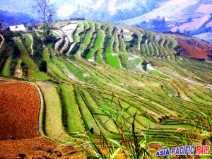
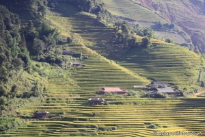
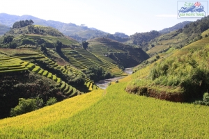
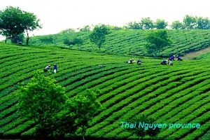
Mountains account most of Thai Nguyen's topography with Tam Dao, Ngan Son, Bac Son ranges. The complex network of rivers includes Cau, Cong, Du, and Rang. The main nature resources are coal, iron, steel, and titan. Thanks to good soil, Thai Nguyen tea, especially tea of Tan Cuong origin has long been a nation- wide famous product.
CLIMATE
There are two seasons: winter lasts from November to April and summer is from May to October. Annual average temperature is 25ºC.
TOURISM
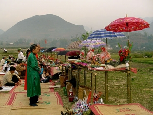
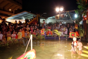
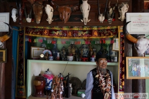
Thai Nguyen has revolutionary tradition, historical vestiges including Van, Vo mountains, Dinh Hoa ATK vestige, and Duom Temple.
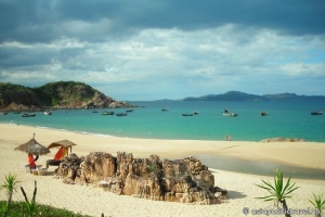
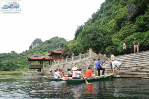
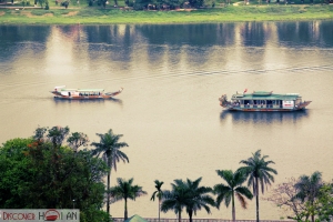
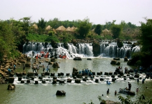
Coming to there, tourists are attracted to visit Nui Coc Reservoir. This 2,500ha lake includes 89 islands, concealing mysterious legends. Nearby the lake, Coc Mountain stands imposingly amid the blue sky, the bright sunshine over every blade of grass and twig, all creating marvelous and splendid scenery.
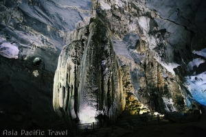
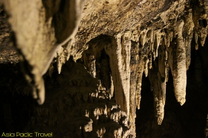
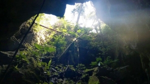
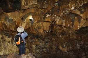
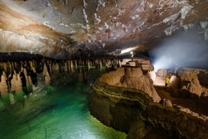
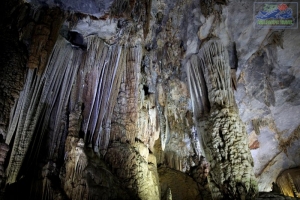
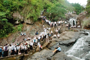
Phuong Hoang Cave and Mo Ga Stream attract many visitors to Thai Nguyen every year. The cave consists of three layers: Doi (Bat), Sang (Light) and Toi (Dark). Reaching the mouth of cave, visitors can see the landscapes of this land.
TRANSPORT
Thai Nguyen City is on National Highway No.3 (Hanoi - Cao Bang), 80km from Hanoi. There is daily train from Hanoi to Quan Trieu, about 8km from center of Thai Nguyen City
THANH HOA PROVINCE
THANH HOA PROVINCE
Square: 11133,4 km2.
Population: 3406,8 thousands people (2010)
City: Thanh Hoa City.
Districts: Muong Lat, Quan Hoa, Quan Son, Ba Thuoc, Cam Thuy, Lang Chanh, Thach Thanh, Ngoc Lac, Thuong Xuan, Nhu Xuan, Nhu Thanh, Vinh Loc, Ha Trung, Nga Son, Yen Dinh, Tho Xuan, Hau Loc, Thieu Hoa, Hoang Hoa, Dong Son, Trieu Son, Quang Xuong, Nong Cong, Tinh Gia.
OVERVIEW
Thanh Hoa is a province in the North Central Coast of Vietnam. Its capital is Thanh Hoa City. The province has a well-known sea resort called Sam Son, which is situated about 15 km from the provincial capital. The largest city in Thanh Hoa is Thanh Hoa city with a population of 176,000 in the city proper. The largest towns are Bim Son (pop. 53,000), Sam Son (pop. 52,000), Tho Xuan, Nga Son and But Son.
GEOGRAPHY
Among of five provinces in North-Central Vietnam, Thanh Hoa Province is surrounded by Son La, Hoa Binh, Ninh Binh provinces on the north, Nghe An Province on the south, East Sea on the east with 102km coastline, and Laos on the west.
TOURISM
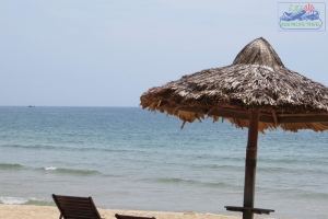
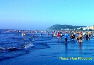
Located 16km from Thanh Hoa City, Sam Son Beach attracts lot of visitors to relax and bath. Beside the beach, Sam Son offers scenic spots such as Trong Mai Rocks, Doc Cuoc Temple and Mount Co Tien.
Tourists also like to discover Ben En National Park in Nhu Thanh, Nhu Xuan districts. The park is a complex of tropical forests, hills, mountains, rivers, springs, and Muc Lake. With natural landscapes and diversified flora and fauna, Ben En is suitable to eco-tourism, sightseeing, and scientific studies.
Cam Luong Fish Spring is another interesting place in Thanh Hoa, The stream contains thousands of fish that no one dares catch it. Fish in the stream have red mouth and fins, and brown scales, resembling carp. Please come to this place to play with fish, visit beautiful caves and grottos, watch dancing performances of Muong people and enjoy traditional lam rice and can wine.
In addition of these, Thanh Hoa is famous of historical vestiges like Ham Rong Bridge, Ho Citadel and Lam Kinh Remains. Lam Son is the birthplace of national hero Le Loi and the starting point of the Lam Son revolutionary insurrection.
TRANSPORT
Thanh Hoa is 153km from Hanoi, 62km from Ninh Binh, and 139km from Vinh (Nghe An). National Highway No.1A and North-South Express Train run through province. There are National Highway No.15 linking to Nghe An and National Highway No.217 connecting to Laos via Na Meo Bordergate.
TIEN GIANG PROVINCE

Square: 2484,2 km2
Population: 1677,0 thousands people (2010)
City: My Tho City.
Districts: Cai Be, Cai Lay, Chau Thanh, Cho Gao, Go Cong Tay, Go Cong Dong, Tan Phuoc, Tan Phu Dong.
OVERVIEW
Located to the North of the Mekong Delta, along the North of Tien River, Long An Province shares border with Long An Province on the north, Dong Thap Province on the west, East Sea on the east, and Ben Tre Province on the south.Tien and Vam Co Tay rivers with Soi Rap, Tieu, Dai river mouths make good condition to develop aquaculture. The terrain is divided into distinct three regions: fruit gardens along the bank of Tien River, plain and seaside.
GEOGRAPHY
Located to the North of the Mekong Delta, along the North of Tien River, Long An Province shares border with Long An Province on the north, Dong Thap Province on the west, East Sea on the east, and Ben Tre Province on the south.
Tien and Vam Co Tay rivers with Soi Rap, Tieu, Dai river mouths make good condition to develop aquaculture. The terrain is divided into distinct three regions: fruit gardens along the bank of Tien River, plain and seaside.
CLIMATE
The dry season lasts from December to April next year. The rainy season is between May and November. Annual average temperature is 27ºC
TOURISM
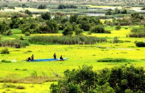
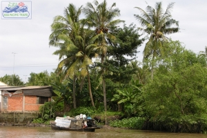
Tien Giang has rich aquatic supply including freshwater fish, brackish fish, and saltwater fish. Some of special fruits are Trung Luong plum, Vinh Kim star-apple, Cai Be guava, sweet mango, rambutan, and thick-skinned orange. Many fruits, vegetable, and other products are anchored on lively Cai Be Floating Market and Tan Phong Island, along Tien Giang River. Visitors also like to picking fruit, enjoy them and experience the life of Mekong River Delta community in orchards of Thoi Son Island.
Located 120km from My Tho City, Dong Tam Snake Farm is an interesting place to see snake, bird and mutant turtles. Vinh Trang Pagoda owns many precious wood statues and beautiful tree in large garden.
TRANSPORT
My Tho City is 70km from Vinh Long, 70km from Ho Chi Minh City, 103km from Can Tho City, 179km from Chau Doc, 182km from Rach Gia.
By Road: There are bus connections with Vinh Long, Chau Doc, Ca Mau, and other destinations in the Mekong Delta.
By Waterway: A high-speed boat leaves from Ho Chi Minh City daily to My Tho and Can Tho. There is also boat tours around My Tho.
TRA VINH PROVINCE
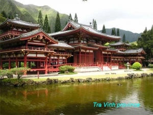
Square: 2295,1 km2
Population: 1005,9 thousands people (2010)
City: Tra Vinh City
Districts: Cang Long, Cau Ke, Tieu Can, Chau Thanh, Tra Cu, Cau Ngang, Duyen Hai.
OVERVIEW
Tra Vinh is a coastal province in the Mekong Delta, bordering the provinces of Ben Tre, Vinh Long, Soc Trang and the East Sea. It has an area of 2292 square kilometers with a population of about 1.1 million people (of which the ethnic Khmer accounts for about 30%), including a provincial city and seven districts.
GEOGRAPHY
Located on Mekong River Delta, Tra Vinh Province borders Ben Tre, Vinh Long provinces on the north, Soc Trang Province on the west, and East Sea on the east with 65km seaside.
Topography includes coastal plain, alluvial deposits, hundreds of mounds and sand caves, a complex network of rivers and canals.
CLIMATE
Tra Vinh is on tropical monsoon region. The weather is hot around the year. The dry season lasts from December to April. The rainy season is between May and November. Annual average temperature is 26ºC.
TOURISM
Surrounded by Tien and Hau rives and long coast, Tra Vinh's economy base on agriculture, aquaculture, fish and shrimp breeding. The province is covered by verdant plants in garden village along bank of river.
Ba Om Pond is an attraction of Tra Vinh. It is surrounded by hillocks and many old sao and dau trees with odd shape of roots. In the afternoon, flocks of birds perch on the trees and make this area exciting and noisy.
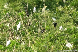
There are 140 pagodas of Khmer, 50 pagodas of Viet (Kinh) and 5 pagodas of Hoa. The famous ones include Ang, Sam-rong-ek, Co, Hang. Co Pagoda is home of thousands of birds including storks, cong coc and pigeons.
TRANSPORT
Tra Vinh Town is 66km from Vinh Long, 205km from Ho Chi Minh City, 110km from Ben Tre, My Tho. There are National Highways No.53, 54, 60 linking the districts of Tra Vinh and neighbor provinces.
TUYEN QUANG PROVINCE
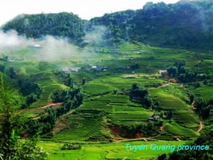
Square: 5870,4 km2.
Population: 728,9 thousands people (2010)
City: Tuyen Quang City.
Districts: Na Hang, Chiem Hoa, Ham Yen, Yen Son, Son Duong.
OVERVIEW
Tuyen Quang owns 300 historical cultural vestiges. The famous one is Tan Trao Historical Site. It was used as a resistance base before the August 1945 Revolution. The main places of interest include Tan Trao Communal House, Hong Thai Communal House and small jungle hut where President Ho Chi Minh lived from June to August 1945.
HISTORY
Tuyen Quang, the capital city of the province has rich history related to the battles fought in the region. The earliest history is to the First Indochina War when it served as a garrison. During this war the Viet Minh made the Legionnaires surrender at the memorial to the Battle of Tuyen Quang.
Another historical event is the Siege of Tuyen Quang, which is still remembered as one of the French Legion's most celebrated feats of arms, and is also commemorated in the first verse of Le Boudin, its principal marching song. The French garrison posted at Tuyen Quang defended the town for four months against 12,000 troops of the Yunnan Army and the Black Flag Army. Two companies of the French Foreign Legion were involved during the Sino-French War (August 1884 to April 1885).
Tuyên Quang used to be entirely settled by Thai people, but from the 13th century onwards were integrated into the Tran dynasty, who named it Quốc Oai before naming it Châu Tuyên Quang. Under the rule of Emperor Trần Hiến Tông (reigned 1329–1341), Tuyên Quang was given the status of a trấn, before being categorised a thành phủ when the Ming Dynasty of China briefly annexed Vietnam at the start of the 15th century. After Le Loi expelled the Chinese and started the Le Dynasty, he made Tuyên Hóa a part of Tây Đạo. During the reign of Emperor Lê Thánh Tông, Tuyên Quang comprised one phủ and five districts (huyện) and became the province of Minh Quang under the rule of Emperor Lê Uy Mục. During the reign of Lê Trang Tông, Minh Quang became An Tại, and control of the region was given to the Vũ family, ethnic Thais.
GEOGRAPHY
Situated on Far-North East, Tuyen Quang Province is surrounded by Ha Giang, Cao Bang, Yen Bai, Bac Kan, Thai Nguyen, Phu Tho, Vinh Phuc provinces.
Mountains occupy almost area of province. The province has natural potentiality of primitive forest and mineral. The main rivers are Lo and Gam.
CLIMATE
Influenced by tropical climate, the summer is very hot. There are two seasons: dry and rainy. Annual average temperature is 24ºC.
TOURISM
Tuyen Quang owns 300 historical cultural vestiges. The famous one is Tan Trao Historical Site. It was used as a resistance base before the August 1945 Revolution. The main places of interest include Tan Trao Communal House, Hong Thai Communal House and small jungle hut where President Ho Chi Minh lived from June to August 1945.
The province also has Na Hang Primitive Forest. It is home of valuable fauna and flora such as dinh, mun (ebony trees), sen (bassia), ape, panther, flying weasel, antelope, and upturned-nosed monkey.
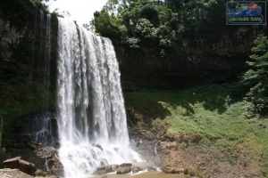
The sounds of the waterfall, birds and gibbons, and silver light going through the thick layers in Thac Mo (Mo Waterfall) provide enjoyable feeling for visitors.
TRANSPORT
The province is on National Highway No.2: Hanoi - Viet Tri - Tuyen Quang - Ha Giang. Tuyen Quang Town is 165km from Hanoi.
HA GIANG PROVINCE

Square: 7945,8 km2
Population: 735,8 thousands people (2010)
City: Ha Giang City
Districts: Dong Van, Meo Vac, Yen Minh, Quan Ba, Bac Me, Hoang Su Phi, Vi Xuyen, Xin Man, Bac Quang, Quang Binh.
OVERVIEW:
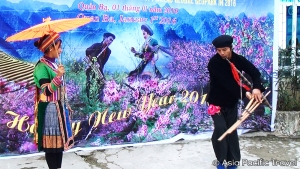
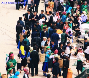
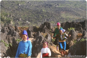
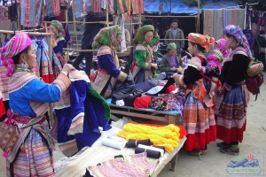
Coming to Ha Giang, tourists are attracted by poetic Dong Van Highland, Love Market of Khau Vai. They can buy embroidery such as handkerchief, haversack, and dress with colorful, fine pattern. They also take part in enjoyable market-day of local ethnics. The people and natural scenes here are unlike anywhere in Vietnam.
GEOGRAPHY:
Located at the highest latitude in Vietnam, Ha Giang is surrounded by Cao Bang on the east, Tuyen Quang on the south, Lao Cai, and Yen Bai on the west. It shares a border with China in the north (274km boundary).
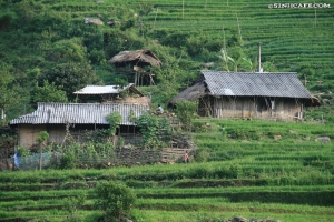
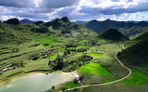
Ha Giang's complicated topography is divided into 3 areas. The area on the south has rocky mountain, separated rivers. The west area has sloping mountain side, high pass, valleys, and narrow springs. The low land area includes hills, valley of Lo River, and Ha Giang Town.
CLIMATE:
The climate is divided in two distinct seasons, rainy and dry, although it tends to vary depending on altitude. The annual average temperature varies between 24 and 28ºC. In winter, the temperature is sometimes down to -5ºC.
TOURISM:
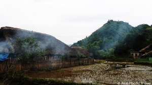
Mountains in Ha Giang are quite high, in which the highest Tay Con Linh point with 2,419m in height. There are good woods, over 1000 kinds of valuable drug trees, animals (tigers, peacocks, phoenix, pangolin) in primitive forests.
Coming to Ha Giang, tourists are attracted by poetic Dong Van Highland, Love Market of Khau Vai. They can buy embroidery such as handkerchief, haversack, and dress with colorful, fine pattern. They also take part in enjoyable market-day of local ethnics. The people and natural scenes here are unlike anywhere in Vietnam.
TRANSPORTATION:
Ha Giang Town is 320km from Hanoi. Ha Giang is on National Highway No.2, 34, 279 linking to Yen Bai, Cao Bang, Lao Cai provinces in turn.
HA NAM PROVINCE
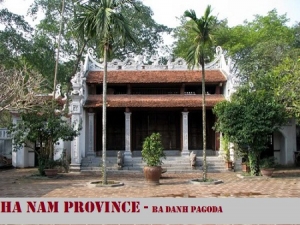
Square: 860,2 km2
Population: 786,3 thousands people (2010)
City: Phu Ly
Districts: Duy Tien, Kim Bang, Ly Nhan, Thanh Liem, Binh Luc.
OVERVIEW:
Ha Nam now preserves many typical culture sights: Long Doi Son, Ba Danh pagodas, Lanh Giang, Tran Thuong, Truc temples...The province is proud of Lieu Doi wrestling, kite, Truc temple festivals, traditional trade villages such as Doi Tam drum, Nha Xa silk handicraft, Thanh Ha embroidery, Ngoc Dong rattan and bamboo villages.
Though not the first tourist destination in the country, Ha Nam province enjoys interesting spots around Phu Ly, the capital of the province, and its other districts. Main attractions include Ngu Dong Son and Cam caves, Long Doi Son pagoda, Truc temple, and the Hoa embroidery village.
GEOGRAPHY:
Ha Nam is located on south of Red River Delta, southern gateway of Hanoi. It shares border with Hung Yen, Ha Tay provinces on the north, Hoa Binh Province on the west, Nam Dinh and Ninh Binh provinces on the south and south-east.
There are two main rivers: Day and Chau Giang rivers. Most of the land in this area is divided by the dense rivers. Therefore, it has the water area of ponds, lagoons, low fields and rivers which are convenient for aquaculture and water poultry rising.
CLIMATE:
Ha Nam has tropical climate: rainy season lasts from October to May and dry season lasts from November to April next year. The annual average temperature is 23ºC.
TOURISM:
Coming to Ha Nam, visitors are interested in natural beauty sights like Truc Temple and Ngu Dong Son (five grottoes), Thuy Grotto (Luon cave), Tam Chuc lake, Phuc Long Grotto.
Ha Nam now preserves many typical culture sights: Long Doi Son, Ba Danh pagodas, Lanh Giang, Tran Thuong, Truc temples...
The province is proud of Lieu Doi wrestling, kite, Truc temple festivals, traditional trade villages such as Doi Tam drum, Nha Xa silk handicraft, Thanh Ha embroidery, Ngoc Dong rattan and bamboo villages.
TRANSPORTATION:
Phu Ly Town is 60km from Hanoi. Road, rail, water transportation are convenient. The province is located on National Highway No.1A.
HA TINH PROVINCE
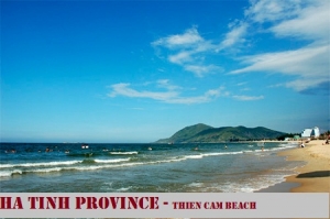
Square: 6025,6 km2
Population: 1228,0 thousands people (2010)
City: Ha Tinh City
Districts: Hong Linh Town, Huong Son, Duc Tho, Nghi Xuan, Can Loc, Huong Khe, Thach Ha, Cam Xuyen, Ky Anh, Vu Quang, Loc Ha.
OVERVIEW:
Ha Tinh has many special internal tourism places ecologically, historically, culturally, namely National Park of Vu Quang, Ke Go reservoir, Hong Linh Mountain, interests inhering to poet Nguyen Du, monument of comrade Tran Phu - First General Secretary of Vietnamese Communist Party, Dong Loc Road Junction - a monument sticking with glorious victory of Vietnam against the US. Then, tourists are able to relax in Xuan Thanh, Thien Cam, Thach Hai or Deo Con beaches, or in medical treatment area of Son Kim Hot Spring.
GEOGRAPHY:
Ha Tinh is located on the Northern Central of Vietnam, surrounded by Nghe An Province on the north, Quang Binh Province on the south, Laos on the west, and East Sea on the east.
Locating at the east of Truong Son Mountain Range, Ha Tinh's terrain is both narrow and sloping, tilting towards the east. To the west is a high mountain range (with average height of 1,500m), following with a range of hills, small and narrow elongated plain and coastal sandy banks.
Mountainous terrain accounts for 80% of the province's natural area that is sharply differentiated and divided, forming deferent ecological areas. There are 14 rivers such as Ngan Pho, Ngan Sau, Cay. The coastline is 137km in length which is suitable for making salt, rearing shellfish such as shrimps, crabs, oysters, snails...
CLIMATE:
Ha Tinh belongs to the tropical monsoon area. The annual average temperature is 23.7ºC. There are two clear seasons: Raining season lasts from August to November. Annually average rainfall is from 2500mm to 2650mm, account to 54% of whole year. Dry season is from December to July next year. The weather is dry, hot and highly vaporizing West- Southern wind (blowing from Laos).
TOURISM:
The province has many special internal tourism places ecologically, historically, culturally, namely National Park of Vu Quang, Ke Go reservoir, Hong Linh Mountain, interests inhering to poet Nguyen Du, monument of comrade Tran Phu - First General Secretary of Vietnamese Communist Party, Dong Loc Road Junction - a monument sticking with glorious victory of Vietnam against the US. Then, tourists are able to relax in Xuan Thanh, Thien Cam, Thach Hai or Deo Con beaches, or in medical treatment area of Son Kim Hot Spring.
Ha Tinh preserves many temples, pagodas such as Cua Dieu Tower, Huong Tich, Bich Chau, Yen Lac pagodas, Tam Lang, Chieu Trung temples.
Coming there, visitor do not forget make tour to some of handicrafts villages such as Van Cham, Minh Long iron, Duc Lam cooper, Cam Trang pottery, Thai Yen wood, Ha silt, Ho cloth.
Apart of that, tourists can follow National Road No. 8 passing Cau Treo Border Gate to Laos, Thailand and other ASEAN countries...
TRANSPORTATION:
The transportation is convenient with National Highway No. 1A and Thong Nhat Express Train crossing the province. There is Keo Nua Border Gate linking to Laos, Thailand. Ha Tinh City is 341km from Hanoi.
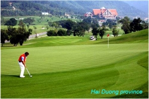
HAI DUONG PROVINCE
Square: 1,652.8 km2.
Population: 1712,8 thousand people (2010)
City: Hai Duong City
Districts: Chi Linh, Nam Sach, Thanh Ha, Kinh Mon, Kim Thanh, Gia Loc, Tu Ky, Cam Giang, Binh Giang, Thanh Mien, Ninh Giang.
OVERVIEW
Hải Dương city is bordered to the northeast by the Nam Sách District and Thanh Hà District. A branch of the Cái River (literally, "mother river" in Vietnamese) divides the city into two parts, on one side the urban area, on the other side lie rural and industrial outskirts. It is bordered to the west by the Cẩm Giàng District, and to the south by the Gia Lộc and Tứ Kỳ districts, and also a branch of the Sat River. The city is located in the centre of both the Northern Economic Area and of the Hanoi–Hai Phong–Quang Ninh development region as well. Hải Dương is located 58 kilometres from Hanoi, 45 kilometres from Hai Phong, and 80 kilometres from Halong Bay. A railway, National Highway No.5 and National Highway No.18 all pass through the province.
HISTORY
- Hai Duong is located in the Red River Delta where originated from civilization of Red River. Hai Duong has had many changes in names throughouts history.It was a part of Duong Tuyen (in the period of King Hung), Giao Chi and Giao Chau ( in the 1st millennium); Nam Sach Lo, Hong Lo (under period of Ly and Tran dynasty); Hong Chau, Nam Sach (in the 16th century); Thua Tuyen, *Hai Duong (in the 10th year of Quang Thuan King).
- Hai Duong province was established in 1831 and was first called “ Thanh Dong” ( East Province) which mean “ the city to the east of Thang Long citadel”.
- In the early 20th century, the patriotic movement was expanded in Hai Duong.
- In 1930s, Hai Duong people carried out two resistance wars against French imperial and American emperor and then won victories.
- In 1968, Hai Duong was merged to Hung Yen to become Hai Hung province.
- In January 1997, Hai Hung was separated in to Hai Duong and Hung Yen.
- In August 1997, The Government decided to upgrade Hai Duong from town to city. Since 1997, Hai Duong has had 11 districts and a city.
GEOGRAPHY
Hai Duong is on the Red River Delta. It borders with Bac Ninh, Bac Giang provinces on the north, Hai Phong, Quang Ninh provinces on the east, Hung Yen Province on the west, Thai Binh Province on the south. The network of rivers includes Thai Binh, Rang, Kinh Thay, and Dao rivers' giving good condition for agriculture and water transportation.
CLIMATE
Hai Duong lies in tropical monsoon climate. The annual average rainfall is 1300 - 1700mm. The average temperature is 23.4ºC.
TOURISM
Long-standing history bequeaths hundreds of cultural, historic relics. They are Phuong Hoang, Kinh Chu An Phu sites, Con Son, Thanh Mai, Hun pagodas, Nguyen Trai, Cao, Kiep Bac temples, Gieng Ngoc (Pearl Well), Thach Ban (Flagstone), of which Con Son - Kiep Bac are most popular ones.

Hai Duong is close related with many celebrities such as Le Huu Trac, Tran Nguyen Dan, Nguyen Trai, Mac Dinh Chi, and Pham Su Manh.
The province is proud of traditional handicraft villages like Chu Dau Pottery, Chau Khe Gold, Dong Dao Carving, Ke Sat Dry Pancake and Hai Duong Green Bean Cake. Folk songs like ca tru, cheo, xam are commonly here.
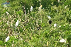
In addition of these, tourists also take interest in Chi Lang Nam Stork Village, home of thousands of white, black, fiery stocks, herons and egrets.
TRANSPORT
The network of road, railway and river-way transportation is convenient. The province lies on railway and National Highway No.5: Hanoi - Hai Duong - Hai Phong, on National Highway No.18: Bac Ninh - Hai Duong - Quang Ninh. Cong Cau river- port has a total capacity of 300,000 tons per year.
Hai Duong is 58km from Hanoi, 45km from Hai Phong, and 80km from Halong Bay.
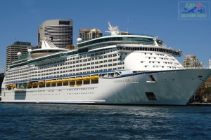
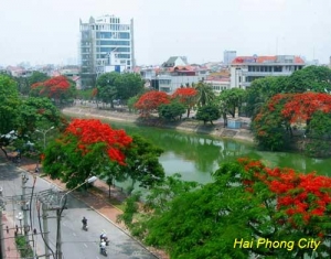
HAI PHONG CITY
Square: 1,520.7 km2.
Population: 1857,8 thousand people (2010):
Districts: Hong Bang, Ngo Quyen, Le Chan, Kien An, Hai An, Duong Kinh, Do Son,Thuy Nguyen, An Duong, An Lao, Kien Thuy, Tien Lang, Vinh Bao, Cat Hai, Bach Long Vi.
OVERVIEW
Hai Phong is a large city with an important seaport of Vietnam. Hai Phong is near Quang Ninh Province to the north, Hai Duong Province to the west, and Thai Binh Province to the south. Because of the proximity to the East Sea, Hai Phong's weather is affected by inter-tropical monsoons. The annual average temperature varies between 23ºC and 24ºC.
HISTORY
Hai Phong was originally founded by Lê Chân, the female general of a Vietnamese revolution against the Chinese led by the Trưng Sisters (Hai Bà Trưng) in the year 43 C.E. The area which is now known as Duong Kinh District was once known as Hai tan Phong thu ("defensive coastal area"), and served as the second capital of the Mac dynasty (1527–1592). At the end of Nguyen Emperor Tu Duc's reign, the headquarters of An Duong District was also moved to Hang Kenh Communal House, which now belongs to Le Chan district.
Haiphong was one of Vietnam's principal ports and trading centers. When the country was invaded by the French, the city became France's main naval base in Indochina. After World War II, when Vietnam attempted to regain its independence, Hai Phong was the site of the first military action undertaken by the French, as punishment for the death of three French soldiers. Some sources claim that the French heavy cruiser Suffren bombarded the city, while others claim it was not Suffren but 3 avisos or sloops, supported by Suffren, the ships that bombarded the city and adjacent fields in an aggression that contributed to the start of the First Indochina War. French infantry forces under the command of Jean-Étienne Valluy invaded the city and fought house to house with support from armored units and jet fighters
GEOGRAPHY
Hai Phong is a large city with an important seaport of Vietnam. Hai Phong is near Quang Ninh Province to the north, Hai Duong Province to the west, and Thai Binh Province to the south.
CLIMATE
Because of the proximity to the East Sea, Hai Phong's weather is affected by inter-tropical monsoons. The annual average temperature varies between 23ºC and 24ºC.
TOURISM
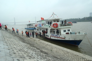
Hai Phong has many temples, pagodas, mausoleums and shrines such as ancient Du Hang Pagoda, Nghe Temple, Hang Kenh Communal House... Hai Phong has famous historical Bach Dang River, where the national heroes defeated three Chinese feudal invasions. The third victory over the Yuan-Mongolians was known all over the world. Many of the teakwood pointed spikes have been discovered in this river. Hai Phong is on tourism route: Hanoi - Hai Phong - Halong Bay. Do Son Beach, located 20km from Hai Phong, is a sand strip for bathing. However, during the monsoon season, the Red River's alluvial sands cause the water to turn yellow. From Do Son, tourist can visit Cat Ba National Park, and continue to Bai Tu Long Bay and Halong Bay (Quang Ninh Province).

Buffalo Fighting - Do Son - Hai Phong City
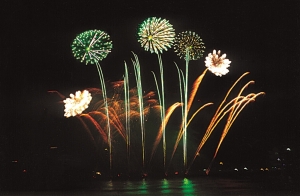
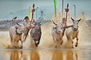
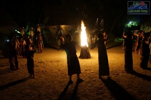
Hai Phong is also famous for many festivals, of which Choi Trau Festival (Do Son Buffalo-fighting festival) in Do Son District is unique.
TRANSPORT
Hai Phong is served by an important transportation network of sea routes, roads, railways, and airlines.
Road: The National Highway No. 10 links Hai Phong to the provinces of Quang Ninh, Thai Binh and Thanh Hoa. Hai Phong is 102km from Hanoi.
Airlines: There are connecting daily flights with Ho Chi Minh City, departed from Cat Bi Airport.
Railway: There are trains from Hanoi to Hai Phong and vice versa.
Boat: Daily ferries from the dock on Ben Binh St. for other destinations. The ferry runs from Hai Phong to Cat Ba Island several times a day. The hydrofoil boats run between Hai Phong - Cat Ba and Hai Phong - Hon Gai. The high-speed air-condition Thong Nhat Boat leave daily from Hai Phong to Cat Ba.