

Asia Pacific Travel Team
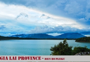
GIA LAI PROVINCE
Square: 15536,9 km2
Population: 1300,9 thousands people (2010)
City: Pleiku City
Districts: An Khe Town, Ayun Pa Town, Chu Pah, Chu Prong, Chu Se, Duc Co, Ia Grai, Kbang, Krong Pa, Kong Chro, Mang Yang, Dak Doa, Ia Pa, Dak Po, Phu Thien.
OVERVIEW:
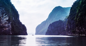
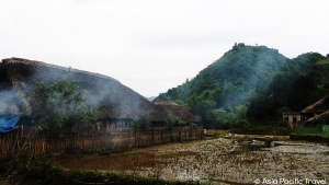
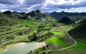
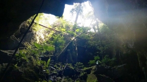
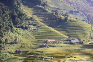
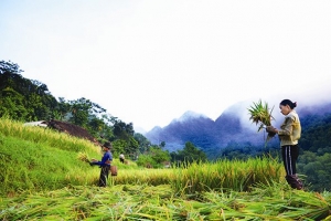
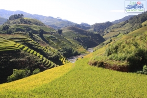
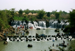
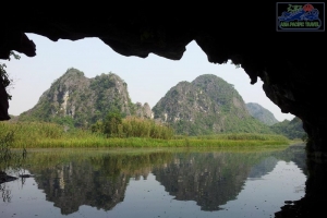
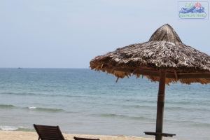
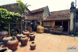
Gia Lai has many beautiful landscapes. Kon Chu Forest is a protected area for wild animals. Other sites include the Ayunpa military base and villages of Ba Na ethnic group. Coming to Gia Lai, visitors have a change to discover many impressive, poetic scenes. They are Kon Ka Kinh, Kon Cha Rang tropical forests, Xung Khoeng Waterfall, Phu Cuong Waterfall, Da Trang, Mo springs and Ayaun Ha Lake. Located on the top of an extinct volcano, Bien Ho (To Nung Lake) is called the 'Pearl of Pleiku'. Its water is so clear that visitors can see fish swimming under blue water.
GEOGRAPHY:
Gia Lai is located in the Central Highlands. It shares the border with Kon Tum Province on the north, Dak Lak Province on the south, Cambodia on the west, Quang Ngai, Binh Dinh, Phu Yen provinces on the east.
Gia Lai is source of Ba and Se San rivers with Yaly hydroelectricity plant. It owns many springs, lakes, waterfalls, rives, and primary forest.
CLIMATE:
There are two seasons: the rainy season lasts from May to November and the dry season lasts from December to April. The annual average temperature varies between 21 and 25ºC. The west of Truong Son Ranges has annual average rainfall is 2,200 - 2,500mm. The east of Truong Son Ranges has annual average rainfall is 1,200 - 1,750mm
TOURISM:
Coming to Gia Lai, visitors have a change to discover many impressive, poetic scenes. They are Kon Ka Kinh, Kon Cha Rang tropical forests, Xung Khoeng Waterfall, Phu Cuong Waterfall, Da Trang, Mo springs and Ayaun Ha Lake. Located on the top of an extinct volcano, Bien Ho (To Nung Lake) is called the 'Pearl of Pleiku'. Its water is so clear that visitors can see fish swimming under blue water.
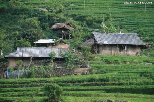
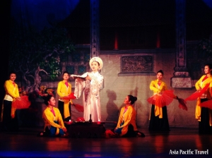
The province is also proud of funeral houses, La Phum, D'ko Tu traditional villages with special Rong house. Whenever going to this windy and sunny land, visitors are likely to see the unique architectural style of the statues in funeral houses, and to investigate the local customs and practice mysterious to them. Apart of that, tens of thousands of visitors are attracted to Dong Xanh Cutural Park in which many typical varieties of flowers and trees of Central Highlands are planted.
Gia Lai has historic sites such as King Quang Trung's guerilla base, Nup hero's homeland, Pleiku Prison, Pleime, Cheo Leo, and La Rang battlefields.
TRANSPORTATION:
Pleiku is 186km from Quy Nhon, 197km from Buon Ma Thuot, and 550km from Ho Chi Minh City.
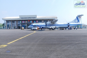
Vietnam Airlines has daily from Da Nang and Ho Chi Minh City to Pleiku Airport. Pleiku Airport is 25km from Pleiku City centre, 45km from Kon Tum.
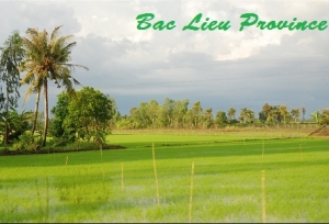
BAC LIEU PROVINCE
Square: 867,8 km2
Population: 2501,5 thousands people (2010)
City: Bac Lieu
Districts: Hong Dan, Vinh Loi, Gia Rai, Dong Hai, Phuoc Long, Hoa Binh
OVERVIEW:
Bac Lieu Province situated in the Mekong River Delta. It shares its border with Can Tho City and Soc Trang Province to the north, the East Sea to the south, Ca Mau and Kien Giang provinces to the west. Bac Lieu has many large rice paddies and fertile land, which make a good condition for fruit tree planting.
HISTORY:
Bac Lieu province was set up on 20 December, 1899 after split from Ha Tien province, consisting of 7 areas: Long Thuy, Quan Xuyen, Quan Long, Quan An, Thanh Hoa, Thanh Hung and Long Thoi.
Then Vietnam authorities devided Bac Lieu province into two provinces: Bac Lieu and An Xuyen. The later Bac Lieu consisted of 4 districts as Gia Rai, Phuoc Long, Vinh Loi and Vinh Chau, 19 communes and 218 hamlets, and its population was 76,630 people in 1965.
In 1976, after the independance of Vietnam, the two provinces Bac Lieu và An Xuyen was merged again into one province namely Minh Hai. On November 6th, 1996, Minh Hai province was devided into two provinces Bac Lieu and Ca Mau.
In the old time, Bac Lieu was known as the land for entertainment with plenty of legends of “Bac Lieu’s fop” because the people here are very open-minded, fond of making friends through festivals and communal cultural activities. This land was not only the home to the very famous musician Cao Van Lau, the composer of a long-living folk song named “Da co hoai lang”, and also extremely attractive to the class of big landlords in the South at the end of the 19th century and beginning of the 20th century.
Therefore, many visitors are very surprised at the luxury villas here which were built according to the Western architectures, much differently from the French buildings in Hanoi, Saigon and Dalat. The special thing is that all of the materials for interior decoration of these buildings such as doors, bricks, wall or flooring marble tiles were bought from Paris by the big landlords.
GEOGRAPHY:
Bac Lieu Province situated in the Mekong River Delta. It shares its border with Can Tho City and Soc Trang Province to the north, the East Sea to the south, Ca Mau and Kien Giang provinces to the west. Bac Lieu has many large rice paddies and fertile land, which make a good condition for fruit tree planting.
CLIMATE:
The weather is divided into two seasons: rainy and dry seasons. The annual average temperature is 24ºC
TOURISM:
Bac Lieu Town is on side of Bac Lieu Canal, 10km from the sea. Bac Lieu residents grow rice, fruit trees, catch seafood and make salt.
Bac Lieu used to play importance role in exploitation and developing of French colonialists so that the province has existed several western-style villas and palaces.
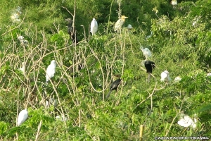
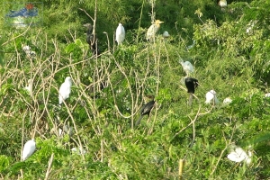
Coming there, tourists have more knowledge about very rich and popular Bac Lieu Mandarins. And they can visit the Bac Lieu Bird Reserve, unforgettable taste longan gardens, Viet Hung old Tower, Xiem Can Pagoda or discover mangrove cajeput forest.
TRANSPORTATION:
Bac Lieu is 280km from Ho Chi Minh City, 67km from Ca Mau, 50km from Soc Trang, and 113km from Can Tho. The National Highway No. 1A crosses the province and links to Soc Trang and Ca Mau provinces.
BAC NINH PROVINCE
Square: 822,7 km2
Population: 1034,2 thousands people (2010)
City: Bac Ninh City
Districts: Que Vo, Yen Phong, Tien Du, Tu Son, Thuan Thanh, Gia Binh, Luong Tai
OVERVIEW:
Bac Ninh is located in the Red River Delta region. It is surrounded by Bac Giang to the north, Hung Yen to the south, Hai Duong to the east, and Hanoi to the west. The topography is quite flat with a complex network of rivers and springs, including Cau, Duong, and Thai Binh rivers.
GEOGRAPHY:
Bac Ninh is located in the Red River Delta region. It is surrounded by Bac Giang to the north, Hung Yen to the south, Hai Duong to the east, and Hanoi to the west. The topography is quite flat with a complex network of rivers and springs, including Cau, Duong, and Thai Binh rivers.
CLIMATE:
The province has moon soon weather, cold winter. The annual average temperature is 24ºC. The highest one is 30ºC in July; the lowest one is 15ºC in January. The annual average rainfall is 1,400mm - 1,600mm. The rainy season lasts from May to October and the dry season lasts from December to April next year.
TOURISM:
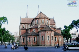
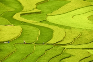
Bac Ninh used to be an ancient trade center of Vietnam from the century 2nd to 10th. Here is the homeland of Buddhism. Buddhism penetrates into this land so early; however, it really bloomed brightly on Ly Dynasty. Hence, visiting this site, tourists will be impressed by a system of old pagodas and temples which reflect all the cultural characters and architecture of Buddhism. Some typical names of pagodas and temples can be given, such as Keo Pagoda, Dau Pagoda, But Thap Pagoda, Phat Tich Pagoda, Do Temple, etc. This is the precious tangible cultural value passing from generations to generations. All the value is also the pride of Bac Ninh’s people that everyone has to try best to preserve.
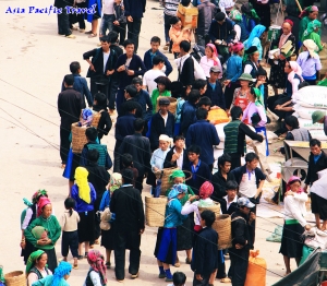
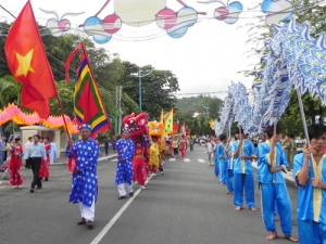
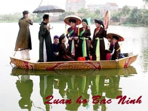
Besides the tangible cultural values, Bac Ninh also possesses intangible ones. These are festivals, which take place mainly in spring in almost pagodas and temples. Therefore, after the Lunar New Year, Bac Ninh is the favorable destination for tourists from all over the country. Especially, Bac Ninh is famous to foreign tourists for the cradle of the traditional folk song – which is called "Quan Ho". This kind of art is annually performed at Lim Festival celebrated in 13th of the first lunar month. For foreign tourists, the experience of joining this festival, listening to “Quan Ho” song will be kept in their minds forever.
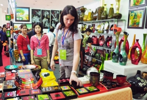
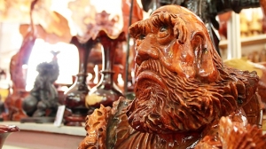
Also, Bac Ninh is well known with such tradition handicraft villages as Dong Ky Wood, Dong Ho Paint, Dai Bai Bronze, and Phu Lang Pottery. You, as a traveler can drop by and join in the daily life of the villages; even you can try making some products by your own and take them as small gifts for your beloved ones
TRANSPORTATION:
Bac Ninh is 30km from Hanoi, 110km from Haiphong, 20km from Bac Giang, 45km from Noi Bai International Airport. It is on the National Highway No.1A, 18, 38.
BEN TRE PROVINCE
Square: 2360,2 km2
Population: 1256,7 thousands people (2010)
City: Ben Tre
Districts: Chau Thanh, Cho Lach, Mo Cay, Giong Trom, Binh Dai, Ba Tri, Thanh Phu
OVERVIEW:
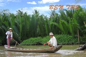
Ben Tre is featured with a plain geography, which is scattered around by sand dunes and adorned by rice fields, fruit plant gardens, and numerous rivers and streams, canals and arroyos. The four Tien Giang river branches, including My Tho, Ba Lai, Ham Luong and Co Chieu rivers, split Ben Tre into 3 islands of Minh, Bao, and An Hoa. All contribute to an ecological system of rivers, canals, arroyos and green trees, facilitating transportation, hydro-electricity, and more importantly, ecological tourism potential.
GEOGRAPHY:
Ben Tre is situated in Mekong Delta. It shares its border with Tien Giang in the north, Vinh Long in the west and south - west, and Tra Vinh in the south. It has 60km seashore. The four main rivers are Tien Giang, Ba Lai, Ham Luong, and Co Chien. They create Bao Minh, and An Hoa islets. The topography is flat with sand dunes and fields. Though rivers surrounding the province, water transportation is very available.
CLIMATE:
It is moon soon climate. The rainy season lasts from May to October. The dry season lasts from December to April next year. The annual average temperature varies between 26 and 27ºC. The annual average rainfall is 1,250mm - 1,500mm
TOURISM:
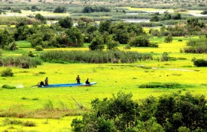
Having complex network of rivers and canals, Ben Tre has advantage to develop ecotourism with many green fruit gardens. Ben Tre is the granary of Mekong Delta. There are agriculture productions such as rice, corn, pineapple, custard-apple, star apple, durian, mango, longan, and many more. Industrial trees are tobacco, sugar-cane, and cotton. Especially, Ben Tre is homeland of coconut. It is known with Ben Tre coconut candy, My Long Cai Mon flower and ornamental plant.
Ben Tre is well known as poet Nguyen Dinh Chieu's motherland. Other popular places are My Hoa Bird Reserve, Con Phung (Hillock of the Coconut Religion), Vam Ho Bird Sanctuary, Vien Minh Pagoda.
TRANSPORTATION:
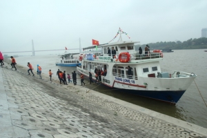
Ben Tre is 14km from Mytho, and 85km from Ho Chi Minh City. National Highway No. 60 and 57 link to Tra Vinh and Tien Giang provinces in turn.Ben Tre is considered as island province accessible by ferry from Mytho. Tourist can visit Ben Tre by high-speech ship for 5 people
BINH DINH PROVINCE
Square: 6039,6 km2
Population: 1489,7 thousands people (2010)
City: Quy Nhon City
Districts: An Lao, Hoai An, Hoai Nhon, Phu My, Phu Cat, Vinh Thanh, Tay Son, Van Canh, An Nhon, Tuy Phuoc.
OVERVIEW:
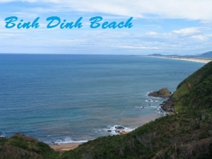
Binh Dinh has a variety of natural and humanity rescourses for tourism development. Its coast has many bays and nice beaches and hamonious and attractive see-sights as: Phuong Mai peninsula, Hoang Hau, Tam Qua, Dao Yen, Qui Hoa, Bai Dai beaches..
GEOGRAPHY:
Binh Dinh is located on the coast of Central Vietnam. It is surrounded by Quang Ngai in the north, Phu Yen in the south, Gia Lai in the west, and the East Sea in the east with the coastline of 100km and some island offshore. The topography is divided in four regions: highlands, midlands, plains, and coast.
CLIMATE:
The annual average temperature varies between 26 and 28ºC. It is hottest in August and coldest in January. The annual average rainfall is 1,700mm - 1,800mm. The rainy season lasts from August to December.
TOURISM:
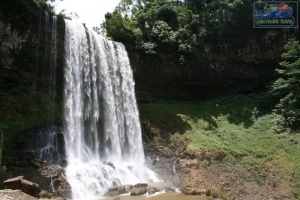
The long coast with many coves and lochs makes many beautiful spots and beaches such as Phuong Mai Peninsula, Queen, Quy Hoa and Ghenh Rang beaches. Besides these, Ham Ho Valley is a beautiful fresh water spot as a change for visitors who prefer tramping in the bush and a swim in the fresh water stream.
Binh Dinh is famous as the centre of the old Sa Huynh Culture. It used to be established as one of the capital cities of the former Cham Kingdom for a long period. The popular Cham towers are Banh It, Duong Long, Canh Tien and Doi. Binh Dinh has special products such as silk, swallow nest, shrimp, fish, precious wood, vegetable oil, rice, marble, titanium, and handicraft articles.
TRANSPORTATION:
Road: Binh Dinh is 1,065km from Hanoi and is accessible either by car, train, or plane. Quy Nhon is 174km from Quang Ngai, 186km from Pleiku, 223km from Buon Ma Thuot, 238km from Nha Trang, 304km from Da Nang and 677km from Ho Chi Minh City. There are National Highways No. 1A and 19.
Bus: There are buses departing to Da Lat, Da Nang, Hanoi, Hue, Nha Trang, Ho Chi Minh City, and others.
Air: Phu Cat Airport is 30km north of Quy Nhon. There are flights between Ho Chi Minh City and Quy Nhon everyday and flights between Da Nang and Quy Nhon twice a week.
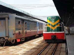
Train: The Thong Nhat Express Train runs from the North to the South through the province. It stops at Dieu Tri, 11km from Quy Nhon.
Water: The province has Quy Nhon Port, an important port of South - Central Coast.
BINH DUONG PROVINCE

Square: 2695,2 km2
Population: 1619,9 thousands people (2010)
City: Thu Dau Mot City
Districts: Ben Cat, Dau Tieng, Tan Uyen, Phu Giao, Thuan An, Di An.
OVERVIEW:
The province preserve famous traditional handicrafts such as pottery, lacquer, sculpture. Binh Duong is located on northen gateway of Saigon and it used to have many long and fierce fighting in anti-American and French resistances. And tourists can visit Lai Thieu Fruit Garden, which is well-known for durian, mangosteen, rambutan, To Nu jack-fruit, then upto Thu Dau Mot Town and Dau Tieng Lake.
GEOGRAPHY:
Binh Duong is located in the south of Vietnam. It is surrounded by Binh Phuoc to the north, Tay Ninh to the west, Dong Nai to the east, and Ho Chi Minh City to the south.
Binh Duong has bazan that is convenient for rubber and coffee trees; alluvial deposits region with many paddy and fruit gardens. The network of rivers and canals are complete with Dong Nai, Sai Gon, Be rivers...
CLIMATE:
There are two seasons in Binh Duong: the dry season lasts from November to April next year, the rainy one lasts from May to October. The annual average temperature is 27ºC.
TOURISM:
Thu Dau Mot Town has 300 year old history. It is on Saigon River bench and it belongs to important economic zone in the south: Ho Chi Minh City - Dong Nai - Ba Ria Vung Tau. The province preserve famous traditional handicrafts such as pottery, lacquer, sculpture. Binh Duong is located on northen gateway of Saigon and it used to have many long and fierce fighting in anti-American and French resistances. And tourists can visit Lai Thieu Fruit Garden, which is well-known for durian, mangosteen, rambutan, To Nu jack-fruit, then upto Thu Dau Mot Town and Dau Tieng Lake. Beside that, Lady Thien Hau Pagoda, Chau Thoi Mountain Pagoda, Tuong Binh Hiep Lacquer ware Painting Village, and Cau Ngang Tourist Area attracts many visitors every year.
TRANSPORTATION:
Binh Duong has National Highway No. 13 and many provincial roads that link to surround provinces. Thu Dau Mot Town is 30km from Ho Chi Minh City, 1,740km from Hanoi, 129km from Tay Ninh and 40km from Dong Nai.
BAC GIANG PROVINCE
Square: 3827,8 km2
Population: 1560,3 thousands people (2010)
City: Bac Giang City
Districts: Son Dong, Luc Ngan, Luc Nam, Yen The, Lang Giang, Yen Dung, Viet Yen, Tan Yen, Hiep Hoa.
OVERVIEW:
Bắc Giang is a province of Vietnam. It is located in the northeastern part of the country, being situated 50 kilometres (31 mi) to the east of the Vietnamese capital, Hanoi. The province covers an area of 3827.45 square kilometres and as of 2008 it had a population of 1,628,400 people.
Bắc Giang Province, Lao Cai, Bắc Kạn, Cao Bang, Ha Giang, Lang Son, Phu Tho, Quang Ninh, Thai Nguyen, Tuyen Quang and Yen Bai of the Đông Bắc (Northeastern Region) are part of the 59 administrative provinces and 5 municipaltites in Vietnam.
Bắc Giang history is traced to the Hung Kings who established the Văn Lang nation, then followed in succession the rule of the Lê Dynasty and the Nguyen Dynasty. It was the prefecture of Đa Phúc during the time of Emperor Tu Duc, Vietnam’s last independent monarch. However, the modern province of Bắc Giang was founded in 1895.
The province lies in the Red River Delta and borders Quảng Ninh to the east, Lạng Sơn to the north, Thái Nguyên and the urban district of Sóc Sơn in the capital Hanoi to the west, and Bắc Ninh and Hải Dương to the south.
Industrial development has been planned intensively in this predominantly agararian province and as result there is discernible improvements in its economic conditions.
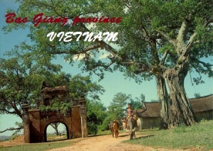
The province has many places of interest to visit such as the Xuong Giang Ancient Citadel, Cam Son Lake, Duc La Pagoda, Tho Ha Communal House.
HISTORY:
During the time of the Hung Kings, who started the nation of Văn Lang, Bắc Giang was in the division of Võ Ninh.
During the Lê Dynasty, the province was the prefecture of Bắc Hà. Following the ascent of the Nguyen Dynasty, it became the prefecture of Thiên Phúc in 1822, before becoming the prefecture of Đa Phúc during the time of Emperor Tu Duc, Vietnam’s last independent monarch. From November 5, 1889 to September 9, 1891 there existed the province of Lục Nam. It comprised the districts of Bảo Lộc, Phượng Nhỡn, Lục Nam, Hữu Lũng (split from Lạng Giang and Bắc Ninh Province) and the district of Yên Bái (split from Lạng Sơn Province). In 1891 after the return of the districts of Bảo Lộc and Phượng Nhỡn back to Bắc Ninh Province, Lục Nam was abolished and integrated into Đạo Quan binh I.
The modern province of Bắc Giang was founded on October 10, 1895, when it was created out of Bắc Ninh Province. It initially comprised the prefectures of Lạng Giang and Đa Phúc and the districts of Kim Anh, Yên Dũng, Phượng Nhỡn, Việt Yên, Hiệp Hòa, Yên Thế and some small territories south of the Lục Nam River. The province capital was Phủ Lạng Thương, which is now the city of Bắc Giang. In 1896, the prefecture of Đa Phúc and the district of Kim Anh was returned to Bắc Ninh Province.
In 1950, Bắc Giang was put into the Confederation of Northern Vietnam (Liên khu Việt Bắc) by the communist Vietminh and comprised seven districts: Hiệp Hoà, Lục Ngạn, Yên Thế, Lạng Giang, Việt Yên, Yên Dũng, Hữu Lũng.
On February 22, 1955, the district of Sơn Động of Quảng Yên Province was incorporated into Bắc Giang Province. On July 1, 1956, upon the formation of the Autonomous Region of Northern Vietnam (Khu tự trị Việt Bắc), the district of Hữu Lũng was transferred to Lạng Sơn Province. On January 21, 1957, the districts of Sơn Động and Lục Ngạn were divided into the three districts of Sơn Động, Lục Ngạn and Lục Nam. On October 27, 1962, Bắc Giang merged with Bắc Ninh into the new province of Hà Bắc, until it was re-partitioned on January 1, 1997 into its previous components.
GEOGRAPHY:
Bắc Giang lies in the Red River Delta. It borders Quảng Ninh to the east, Lạng Sơn to the north, Thái Nguyên and the urban district of Sóc Sơn in the capital Hanoi to the west, and Bắc Ninh and Hải Dương to the south. It comprises three land forms namely, the lowland or the delta land, the midland and the mountainous region. While the midland areas are in the districts of Hiep Hoa and Viet Yen and the Bac Giang city, the mountanous districts are the Son Dong, Luc Ngan, Yen The, Tan Yen, Yen Dung, Lang Giang; the seven mountanous districts account for 72% of area of the Bac Giang province.
Of the total land area of the province, 123,000 hectares (300,000 acres) is agricultural land,110,000 hectares (270,000 acres) is forest land, 66,500 hectares (164,000 acres) is residential and urban land and for other uses. The farmland in the proivnce is good intensive farming of rice crops vegetable, fruit and bulb trees. There is scope for expanding land under forests. The produce from the forests has been estimated as 3,5 million m3 of wood and 500 million trees of bamboo and neohouzeaua.
Bắc Giang occupies an area of 3,827.45 square kilometres (1,477.79 sq mi),[9] which is 1.2% of the area of the whole country. According to statistics from 2000, 32.4% of the land is used for agriculture, while 28.9% is used for forestry, industry or is otherwise uncleared. The remainder comprises mountains, unexploited waterways and land used for miscellaneous purposes.
The province is 50 kilometres (31 mi) from Hanoi and has a good network of roads such as the National Highways No. 1A, 31 and 279. It has railway lines from Bac Giang to Hanoi, Lang Son, Thai Nguyen and mineral areas in Quang Ninh by train.
The terrain is moderately mountainous, lying between the high mountains to the north and the Red River Delta to the south. Although a large part of the terrain is mountainous most of it is not isolated. The region to the northern end of the province is mountainous uncleared forest. To the east and southeast of the province is Đông Triều and the Mount Yên Tử, located with the Yên Tử Nature Reserve. The elevation of the province is mostly in the 300–900 metres (980–3,000 ft) range, with a maximum of 1,068 metres (3,504 ft) (Mount Yên Tử). To the northeastern end of the province, along the border with Quảng Ninh there is the Khe Rỗ forest, spanning 71.53 km2, with a rich biodiversity.
Bắc Giang has a total of 347 km of rivers and springs, the three most prominent being Lục Nam River, Thương River and the Cầu River. Apart from waterways, Bắc Giang has many lakes, including Cấm Sơn Lake and Khuôn Thần Lake; the area covered by ponds, lakes and lagoons is 16,300 hectares (40,000 acres). Cấm Sơn Lake lies in Luc Nagan district of the province in the area bordering the province of Lạng Sơn. It is30 kilometres (19 mi) long and has a width varying from 200 metres (660 ft) up to7 kilometres (4.3 mi). It has an area of 26 square kilometres (10 sq mi), but this can increase to 30 kilometres (19 mi) during monsoonal flooding. Khuôn Thần Lake has an area of2.4 square kilometres (0.93 sq mi) and the centre of the lake has five small hilly islands surrounded by 20-year-old pine forests. Pedalboating and motorboating are permitted on the lake. Ethnic minority hamlets are located on the shores of the lake. Apprroach route to the lake is from Bac Ninh - 31 kilometres (19 mi)), then to Bac Giang - 51 kilometres (32 mi)), further to the Hoa River-98 kilometres (61 mi) and finally arrive at the Cam Son Lake.The highest flow in the Thuong River is reported to be 64.4 m3/s and lowest flow is 12.9 m3/s.
CLIMATE:
The province has the dominant charechteristics of the tropical and temperate climate zone of the Northern Plain. The temperature, humidity and rainfall indexes clearly vary over months and seasons. The climate in the province has been discerned in two distinct seasons - the hot, rainy season from May to September and the cold, dry season from November to March. The average temperature varies between 22–23 °C (72–73 °F); the Maximum Temperatures recorded was 41 °C (106 °F) while the lowest temperature was 13 °C (55 °F). Humidity values are in the range of 73% to 87%. The average rainfall is reported to be 1,953 millimetres (76.9 in). The annual Sun shine hours of 1,500 to 1,700 hours is good to grow tropical and subtropical trees. The average wind velocity is 2.1 metres (6.9 ft)/s and average atmosphere pressure 757.71 mmHg. Since the province is located away from the East Sea, the incidence of hurricanes and storms is rare though Whirlwind and hail storm are a localised phenomenon in a few mountainous districts.
TOURISM:
Bac Giang has many beautiful sites and vestiges such as Khe Ro Primitive Forest, Suoi Mo Site, Xuong Giang Ancient Citadel Other interesting sights as Cam Son Lake, Khuon Than Resort.
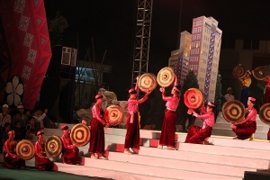
The province has cultural traditional festival of Kinh Bac people, as well as spring festivals of ethnic groups.
TRANSPORTATION:
Bac Giang is 51km from Hanoi.
Road: There are national highway No. 1A, 31, and 279.
Railway: From Bac Giang to Hanoi, Lang Son, Thai Nguyen, and mineral area in Quang Ninh by train.
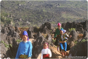
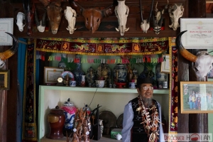
The La Hu ethnic group - The cultural beauty of northern highland
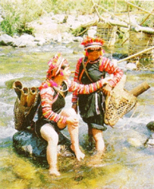
Name of ethnic group: La Hu (Xa La Vang, Co Rung, Khu Sung, and Kha Quy)
Population: 6,874 people (Year 1999)
Locality: Muong Te District of Lai Chau Province.
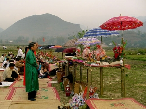
Customs and habits: The La Hu live in villages built on mountain slopes. These houses are level with the ground and divided by bamboo partitions. The altar for the ancestors and the kitchen are always placed at the bay of the house, which is used for the family sleeping quarters. The right of inheritance is only reserved for sons. Young men and women are free to choose their partners. After the wedding, the groom has to live with his wife's family for several years, but then takes his wife to his family house.
La Hu women usually give birth in their bedroom. Three days later, the baby is given its name. If an unexpected guest comes during this time, he or she is given the honour of naming the newborn. The worship of the ancestors is reserved for the dead parents. Every year the La Hu hold ceremonies to worship the spirits of the earth and to pray for peace. They conjure up the souls of the corn and the rice spirits after the sowing and harvesting duties have been completed.
Culture: La Hu language belongs to the Tibeto-Burman Group. There are a dozen "khen" (pan-pipe) dances in La Hu culture. The songs are sung in the Ha Nhi language, but the La Hu have kept their own rhythms. The La Hu have a rich heritage of ancient tales, and they even maintain their own calendar in which the days are defined corresponding to twelve animals, including the tiger, rabbit, dragon, mouse, sheep, monkey, rooster, dog, pig, squirrel, snake and buffalo.
Costumes: Women wear trousers and a long-lap shirt that falls to their ankles. They also wear a short vest during festive days. The collar, chest stripes, and sleeves are either embroidered or sewn with colourful pieces of cloth, silver, tin coins, or red fringes.
Economy: The La Hu live on slash-and-burn cultivation and hunting. La Hu men are very skilled at blacksmithing and making rattan chairs, trays, mats.
The Lao ethnic group - National character of the end of northwestern heaven
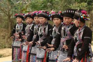
Name of ethnic group: Lao (Lao Boc and Lao Noi)
Population: 11,611 people (Year 1999)
Locality: Concentrated in Dien Bien City (Dien Bien Province); Phong Tho and Than Uyen districts (Lai Chau Province); Song Ma District (Son La Province).
Customs and habits: The Lao worship their ancestors and are influenced by Buddhism. The Lao often take the family names of Lo, Luong, or Vi. Children take the family name of their father. When a person dies, a funeral ceremony and burial is carefully organized. Cremation occurs only if the deceased is the chief of a "muong" or a "ban" (village).
Culture: The Lao language belongs to the Tay-Thai Group. The "mo lam" (sorcerers) of Lao culture are very good at writing and narrating ancient tales and folksongs. Lao folklore and its legacy is heavily influenced by Thai culture. The "lam vong" (Lao folk dance) are always performed during festivals and ceremonies.
Costumes: Women wear black skirts that are knotted at the front and come up to their chests. The hems are usually decorated with two bands of embroidered motifs in different colors. Lao men used to have a Han script and an animal tattooed on their wrist and thighs.

Economy: The Lao primarily grow rice in submerged fields using advanced techniques such as ploughing, harrowing, and irrigating. Additional family income is generated through weaving, blacksmithing, pottery, and silver production.
The meek, plain beauty of the Lo Lo ethnic group land
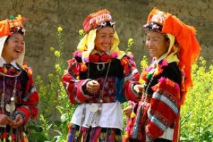
Name of ethnic group: Lo Lo (Mun Di, Lo Lo Hoa and Lo Lo Den)
Population: 3,307 people (Year 1999)
Locality: Dong Van and Meo Vac districts of Ha Giang Province, Bao Lac District of Cao Bang Province and Muong Khuong District of Lao Cai Province.
Customs and habits: The Lo Lo mainly worship their ancestors. Their villages are located on mountain slopes close to sources of water. They live in grouped villages, each village having 20 to 25 houses. These houses are built either on stilts, half on stilts and half on the ground, or level with the ground. People of the same lineage live in the same village. The leader of the lineage is called the Thau Chu. This leader is responsible for ritual ceremonies and the preservation of the customs of that lineag e. The Lo Lo practice monogamy and the wife comes to live in her husband's house after marriage. The Lo Lo use bronze drums for special occasions, but bury these drums in the earth for maintenance, and unearth them only for usage. The head of each family lineage is the keeper of the bronze drums. These drums are only used at funerals or to keep time during dances.
Culture: The Lo Lo language belongs to the Tibeto-Burman Group. Their written language used pictographic scripts which are no longer in use. The calendar of the Lo Lo divides the year into 11 months, each corresponding to the name of an animal. The folklore culture of the Lo Lo is diverse. It is expressed particularly well in dances, songs, and old tales. The Lo Lo people have a high level of education, as many are university graduates or they have finished secondary education.
Costumes: The Lo Lo Hoa women often wear a low-neck vest and a pair of trousers underneath a short skirt. Lo Lo Den men wear pajama-style trousers and a square necked vest pulled over their heads. Colourful designs are incorporated into their turbans, vests, skirts, and trousers.
Economy: The Lo Lo depend mainly on maize and rice as forms of income generation.